
Popular platforms include Google Earth Engine, NASA’s Earthdata, and Sentinel Hub, each offering unique features that cater to different user needs. These platforms provide user-friendly interfaces and robust tools for analyzing satellite soil spectral indices, which simplifies the process for users who may not have extensive technical expertise.
Additionally, many platforms provide tutorials and documentation to assist users in navigating the complexities of remote sensing data, empowering them to utilize these tools effectively. This accessibility is crucial for ensuring that researchers and farmers alike can make informed decisions based on accurate satellite-derived data.
By utilizing these platforms, users can access a wealth of satellite data for soil monitoring and management, which is essential for making informed decisions regarding crop health and soil conservation. This data is invaluable for optimizing agricultural practices and enhancing overall productivity while maintaining sustainability.
As remote sensing technology continues to advance, these platforms are expected to evolve further, offering enhanced capabilities and features that will improve the user experience. Enhanced processing capabilities will likely improve the accuracy and efficiency of soil analysis, benefiting the agriculture sector and contributing to more sustainable practices.
Limitations of Satellite Soil Spectroscopy and How Research Is Addressing Them
While satellite soil spectroscopy offers numerous benefits, it also has its limitations that can impact the accuracy and reliability of soil assessments. Factors such as atmospheric interference, spatial resolution, and data interpretation challenges can affect the precision of the soil data collected, making it essential to address these issues through ongoing research and development.
Research is actively addressing these limitations through improved algorithms and data processing techniques that enhance the quality of satellite soil spectral indices. By enhancing satellite soil spectral indices and refining validation methods, scientists are working to increase the precision of soil monitoring, ensuring that farmers and researchers can trust the data they rely on.
Furthermore, ongoing advancements in satellite technology, including higher resolution sensors and improved data processing capabilities, promise to mitigate some of these challenges. These improvements will enhance the overall effectiveness of satellite soil monitoring, making it an even more valuable tool for modern agriculture.
Additionally, interdisciplinary collaboration among soil scientists, remote sensing experts, and data analysts is vital for overcoming existing hurdles and developing innovative solutions. By sharing knowledge and resources, the agricultural community can make significant strides in soil health management and contribute to sustainable agriculture.
Ultimately, addressing these limitations will lead to more accurate and reliable satellite soil monitoring, which is essential for promoting sustainable agricultural practices and ensuring food security worldwide. As the technology continues to evolve, the potential for satellite soil analysis to contribute to agricultural productivity and environmental stewardship will only increase.
This combination of satellite soil spectral indices enhances the spatial resolution and reliability of soil data, enabling more precise decision-making in agricultural practices. Consequently, it allows for improved crop management strategies that are rooted in reliable and timely information about soil health.
Utilizing data from Sentinel satellites provides high-resolution imagery that is essential for local assessments, while Landsat offers long-term historical data that helps track changes over time. In contrast, DESIS specializes in hyperspectral imaging, delivering detailed spectral information for soil analysis that can reveal intricate details about soil composition and health.
By fusing these datasets, researchers can create comprehensive soil maps that reflect current conditions and trends, which is invaluable for effective land management. This approach enables more effective monitoring of soil health and informs precision agriculture initiatives that aim to enhance productivity while minimizing environmental impact.
Ultimately, data fusion is a powerful tool for enhancing satellite soil monitoring capabilities and improving the overall quality of soil assessments. This technique not only improves soil mapping but also supports sustainable agricultural practices through better resource management, ensuring that farmers can respond effectively to changing conditions.
Access and Processing Platforms for Agricultural Soil Remote Sensing
Accessing and processing satellite data for agricultural soil remote sensing is crucial for effective analysis and informed decision-making in farming practices. Several platforms are available that facilitate the retrieval and processing of satellite imagery for soil analysis, making it easier for researchers and farmers to leverage these advanced technologies.
Popular platforms include Google Earth Engine, NASA’s Earthdata, and Sentinel Hub, each offering unique features that cater to different user needs. These platforms provide user-friendly interfaces and robust tools for analyzing satellite soil spectral indices, which simplifies the process for users who may not have extensive technical expertise.
Additionally, many platforms provide tutorials and documentation to assist users in navigating the complexities of remote sensing data, empowering them to utilize these tools effectively. This accessibility is crucial for ensuring that researchers and farmers alike can make informed decisions based on accurate satellite-derived data.
By utilizing these platforms, users can access a wealth of satellite data for soil monitoring and management, which is essential for making informed decisions regarding crop health and soil conservation. This data is invaluable for optimizing agricultural practices and enhancing overall productivity while maintaining sustainability.
As remote sensing technology continues to advance, these platforms are expected to evolve further, offering enhanced capabilities and features that will improve the user experience. Enhanced processing capabilities will likely improve the accuracy and efficiency of soil analysis, benefiting the agriculture sector and contributing to more sustainable practices.
Limitations of Satellite Soil Spectroscopy and How Research Is Addressing Them
While satellite soil spectroscopy offers numerous benefits, it also has its limitations that can impact the accuracy and reliability of soil assessments. Factors such as atmospheric interference, spatial resolution, and data interpretation challenges can affect the precision of the soil data collected, making it essential to address these issues through ongoing research and development.
Research is actively addressing these limitations through improved algorithms and data processing techniques that enhance the quality of satellite soil spectral indices. By enhancing satellite soil spectral indices and refining validation methods, scientists are working to increase the precision of soil monitoring, ensuring that farmers and researchers can trust the data they rely on.
Furthermore, ongoing advancements in satellite technology, including higher resolution sensors and improved data processing capabilities, promise to mitigate some of these challenges. These improvements will enhance the overall effectiveness of satellite soil monitoring, making it an even more valuable tool for modern agriculture.
Additionally, interdisciplinary collaboration among soil scientists, remote sensing experts, and data analysts is vital for overcoming existing hurdles and developing innovative solutions. By sharing knowledge and resources, the agricultural community can make significant strides in soil health management and contribute to sustainable agriculture.
Ultimately, addressing these limitations will lead to more accurate and reliable satellite soil monitoring, which is essential for promoting sustainable agricultural practices and ensuring food security worldwide. As the technology continues to evolve, the potential for satellite soil analysis to contribute to agricultural productivity and environmental stewardship will only increase.
This monitoring is essential for assessing the impact of land use and agricultural practices on soil carbon levels, helping to identify trends and inform sustainable land management strategies. By analyzing trends in soil carbon, researchers can better inform policies aimed at promoting sustainable agriculture and mitigating climate change impacts.
- Earth observation data for carbon tracking, enabling informed decision-making
- Assessment of land use impacts on soil carbon levels, fostering sustainable practices
- Long-term soil health monitoring to track changes and implement corrective measures
- Support for carbon offset initiatives, promoting environmental stewardship
- Integration with climate change strategies to enhance resilience in agricultural systems
Through temporal monitoring, it becomes possible to identify areas of soil degradation and implement corrective measures that can enhance soil health. This proactive approach to soil management is essential for maintaining healthy agricultural systems that can withstand the challenges posed by climate variability and human activity.
The insights gained from monitoring soil organic carbon can significantly influence agricultural practices and policy-making, leading to more effective strategies for enhancing soil health. By prioritizing soil health and carbon sequestration, we can contribute to both environmental sustainability and food security, ensuring a resilient future for agriculture.
Data Fusion: Combining Sentinel, Landsat and DESIS for Soil Mapping
Data fusion techniques are revolutionizing soil mapping by combining data from multiple satellite sources, allowing for a more comprehensive understanding of soil characteristics across diverse landscapes. By integrating information from Sentinel, Landsat, and DESIS, researchers can achieve more accurate and detailed soil assessments that enhance the effectiveness of precision agriculture practices.
This combination of satellite soil spectral indices enhances the spatial resolution and reliability of soil data, enabling more precise decision-making in agricultural practices. Consequently, it allows for improved crop management strategies that are rooted in reliable and timely information about soil health.
Utilizing data from Sentinel satellites provides high-resolution imagery that is essential for local assessments, while Landsat offers long-term historical data that helps track changes over time. In contrast, DESIS specializes in hyperspectral imaging, delivering detailed spectral information for soil analysis that can reveal intricate details about soil composition and health.
By fusing these datasets, researchers can create comprehensive soil maps that reflect current conditions and trends, which is invaluable for effective land management. This approach enables more effective monitoring of soil health and informs precision agriculture initiatives that aim to enhance productivity while minimizing environmental impact.
Ultimately, data fusion is a powerful tool for enhancing satellite soil monitoring capabilities and improving the overall quality of soil assessments. This technique not only improves soil mapping but also supports sustainable agricultural practices through better resource management, ensuring that farmers can respond effectively to changing conditions.
Access and Processing Platforms for Agricultural Soil Remote Sensing
Accessing and processing satellite data for agricultural soil remote sensing is crucial for effective analysis and informed decision-making in farming practices. Several platforms are available that facilitate the retrieval and processing of satellite imagery for soil analysis, making it easier for researchers and farmers to leverage these advanced technologies.
Popular platforms include Google Earth Engine, NASA’s Earthdata, and Sentinel Hub, each offering unique features that cater to different user needs. These platforms provide user-friendly interfaces and robust tools for analyzing satellite soil spectral indices, which simplifies the process for users who may not have extensive technical expertise.
Additionally, many platforms provide tutorials and documentation to assist users in navigating the complexities of remote sensing data, empowering them to utilize these tools effectively. This accessibility is crucial for ensuring that researchers and farmers alike can make informed decisions based on accurate satellite-derived data.
By utilizing these platforms, users can access a wealth of satellite data for soil monitoring and management, which is essential for making informed decisions regarding crop health and soil conservation. This data is invaluable for optimizing agricultural practices and enhancing overall productivity while maintaining sustainability.
As remote sensing technology continues to advance, these platforms are expected to evolve further, offering enhanced capabilities and features that will improve the user experience. Enhanced processing capabilities will likely improve the accuracy and efficiency of soil analysis, benefiting the agriculture sector and contributing to more sustainable practices.
Limitations of Satellite Soil Spectroscopy and How Research Is Addressing Them
While satellite soil spectroscopy offers numerous benefits, it also has its limitations that can impact the accuracy and reliability of soil assessments. Factors such as atmospheric interference, spatial resolution, and data interpretation challenges can affect the precision of the soil data collected, making it essential to address these issues through ongoing research and development.
Research is actively addressing these limitations through improved algorithms and data processing techniques that enhance the quality of satellite soil spectral indices. By enhancing satellite soil spectral indices and refining validation methods, scientists are working to increase the precision of soil monitoring, ensuring that farmers and researchers can trust the data they rely on.
Furthermore, ongoing advancements in satellite technology, including higher resolution sensors and improved data processing capabilities, promise to mitigate some of these challenges. These improvements will enhance the overall effectiveness of satellite soil monitoring, making it an even more valuable tool for modern agriculture.
Additionally, interdisciplinary collaboration among soil scientists, remote sensing experts, and data analysts is vital for overcoming existing hurdles and developing innovative solutions. By sharing knowledge and resources, the agricultural community can make significant strides in soil health management and contribute to sustainable agriculture.
Ultimately, addressing these limitations will lead to more accurate and reliable satellite soil monitoring, which is essential for promoting sustainable agricultural practices and ensuring food security worldwide. As the technology continues to evolve, the potential for satellite soil analysis to contribute to agricultural productivity and environmental stewardship will only increase.
This validation process helps identify discrepancies between satellite observations and actual soil conditions, providing critical feedback that can be used to enhance the reliability of satellite soil monitoring. As a result, it enhances the overall effectiveness of soil analysis, making it a vital component in precision agriculture.
Ground-level measurements can include soil sampling, moisture content analysis, and nutrient profiling, which provide a benchmark against which satellite-derived predictions can be assessed. These on-the-ground data points are crucial for verifying the accuracy of satellite observations and ensuring that farmers receive reliable information about their soil conditions.
Through this process, researchers can also determine which satellite soil spectral indices best correlate with ground measurements, leading to improved calibration of satellite data. This insight is invaluable for calibrating satellite data and improving the accuracy and reliability of soil assessments, which are critical for effective agricultural management.
Ultimately, validating satellite predictions enhances the overall effectiveness of precision agriculture practices and allows farmers to make better-informed decisions regarding soil management and crop production. With accurate data, farmers can implement strategies that maximize yield while minimizing environmental impact, leading to more sustainable agricultural practices.
Temporal Monitoring of Soil Organic Carbon at Continental Scale
Temporal monitoring of soil organic carbon is vital for understanding soil health and carbon sequestration efforts, which are increasingly important in the context of climate change. Utilizing satellite technologies allows for the tracking of soil organic carbon changes over time at a continental scale, providing critical data for researchers and policymakers.
This monitoring is essential for assessing the impact of land use and agricultural practices on soil carbon levels, helping to identify trends and inform sustainable land management strategies. By analyzing trends in soil carbon, researchers can better inform policies aimed at promoting sustainable agriculture and mitigating climate change impacts.
- Earth observation data for carbon tracking, enabling informed decision-making
- Assessment of land use impacts on soil carbon levels, fostering sustainable practices
- Long-term soil health monitoring to track changes and implement corrective measures
- Support for carbon offset initiatives, promoting environmental stewardship
- Integration with climate change strategies to enhance resilience in agricultural systems
Through temporal monitoring, it becomes possible to identify areas of soil degradation and implement corrective measures that can enhance soil health. This proactive approach to soil management is essential for maintaining healthy agricultural systems that can withstand the challenges posed by climate variability and human activity.
The insights gained from monitoring soil organic carbon can significantly influence agricultural practices and policy-making, leading to more effective strategies for enhancing soil health. By prioritizing soil health and carbon sequestration, we can contribute to both environmental sustainability and food security, ensuring a resilient future for agriculture.
Data Fusion: Combining Sentinel, Landsat and DESIS for Soil Mapping
Data fusion techniques are revolutionizing soil mapping by combining data from multiple satellite sources, allowing for a more comprehensive understanding of soil characteristics across diverse landscapes. By integrating information from Sentinel, Landsat, and DESIS, researchers can achieve more accurate and detailed soil assessments that enhance the effectiveness of precision agriculture practices.
This combination of satellite soil spectral indices enhances the spatial resolution and reliability of soil data, enabling more precise decision-making in agricultural practices. Consequently, it allows for improved crop management strategies that are rooted in reliable and timely information about soil health.
Utilizing data from Sentinel satellites provides high-resolution imagery that is essential for local assessments, while Landsat offers long-term historical data that helps track changes over time. In contrast, DESIS specializes in hyperspectral imaging, delivering detailed spectral information for soil analysis that can reveal intricate details about soil composition and health.
By fusing these datasets, researchers can create comprehensive soil maps that reflect current conditions and trends, which is invaluable for effective land management. This approach enables more effective monitoring of soil health and informs precision agriculture initiatives that aim to enhance productivity while minimizing environmental impact.
Ultimately, data fusion is a powerful tool for enhancing satellite soil monitoring capabilities and improving the overall quality of soil assessments. This technique not only improves soil mapping but also supports sustainable agricultural practices through better resource management, ensuring that farmers can respond effectively to changing conditions.
Access and Processing Platforms for Agricultural Soil Remote Sensing
Accessing and processing satellite data for agricultural soil remote sensing is crucial for effective analysis and informed decision-making in farming practices. Several platforms are available that facilitate the retrieval and processing of satellite imagery for soil analysis, making it easier for researchers and farmers to leverage these advanced technologies.
Popular platforms include Google Earth Engine, NASA’s Earthdata, and Sentinel Hub, each offering unique features that cater to different user needs. These platforms provide user-friendly interfaces and robust tools for analyzing satellite soil spectral indices, which simplifies the process for users who may not have extensive technical expertise.
Additionally, many platforms provide tutorials and documentation to assist users in navigating the complexities of remote sensing data, empowering them to utilize these tools effectively. This accessibility is crucial for ensuring that researchers and farmers alike can make informed decisions based on accurate satellite-derived data.
By utilizing these platforms, users can access a wealth of satellite data for soil monitoring and management, which is essential for making informed decisions regarding crop health and soil conservation. This data is invaluable for optimizing agricultural practices and enhancing overall productivity while maintaining sustainability.
As remote sensing technology continues to advance, these platforms are expected to evolve further, offering enhanced capabilities and features that will improve the user experience. Enhanced processing capabilities will likely improve the accuracy and efficiency of soil analysis, benefiting the agriculture sector and contributing to more sustainable practices.
Limitations of Satellite Soil Spectroscopy and How Research Is Addressing Them
While satellite soil spectroscopy offers numerous benefits, it also has its limitations that can impact the accuracy and reliability of soil assessments. Factors such as atmospheric interference, spatial resolution, and data interpretation challenges can affect the precision of the soil data collected, making it essential to address these issues through ongoing research and development.
Research is actively addressing these limitations through improved algorithms and data processing techniques that enhance the quality of satellite soil spectral indices. By enhancing satellite soil spectral indices and refining validation methods, scientists are working to increase the precision of soil monitoring, ensuring that farmers and researchers can trust the data they rely on.
Furthermore, ongoing advancements in satellite technology, including higher resolution sensors and improved data processing capabilities, promise to mitigate some of these challenges. These improvements will enhance the overall effectiveness of satellite soil monitoring, making it an even more valuable tool for modern agriculture.
Additionally, interdisciplinary collaboration among soil scientists, remote sensing experts, and data analysts is vital for overcoming existing hurdles and developing innovative solutions. By sharing knowledge and resources, the agricultural community can make significant strides in soil health management and contribute to sustainable agriculture.
Ultimately, addressing these limitations will lead to more accurate and reliable satellite soil monitoring, which is essential for promoting sustainable agricultural practices and ensuring food security worldwide. As the technology continues to evolve, the potential for satellite soil analysis to contribute to agricultural productivity and environmental stewardship will only increase.
Commonly used indices include the Normalized Difference Vegetation Index (NDVI) and the Soil Adjusted Vegetation Index (SAVI), each serving distinct purposes in soil analysis. These indices allow for a comprehensive analysis of soil conditions, enabling farmers and researchers to better understand the factors influencing crop health.
For instance, NDVI is primarily used to assess vegetation health but can also provide insights into soil moisture levels, making it an important tool for farmers. Meanwhile, SAVI is tailored to minimize the influence of soil brightness on vegetation measurements, making it ideal for areas with sparse vegetation and enabling accurate assessments of soil conditions.
Other important indices include the Enhanced Vegetation Index (EVI) and the Normalized Burn Ratio (NBR), each contributing to the understanding of soil properties like organic matter and nutrient content. By employing these satellite soil spectral indices, farmers and researchers can gain deeper insights into soil health and make informed decisions regarding crop management strategies.
The integration of these indices into precision agriculture practices enhances sustainability and productivity, ensuring that agricultural practices are grounded in reliable data. As a result, the application of satellite-derived indices is becoming increasingly essential for modern farming methodologies.
Validating Satellite Predictions Against Ground-Level Spectral Measurements
Validation of satellite predictions against ground-level spectral measurements is essential for ensuring the accuracy of soil assessments and enhancing the credibility of remote sensing technologies. By comparing satellite data with on-ground measurements, researchers can refine their models and improve predictive capabilities, leading to more effective agricultural practices.
This validation process helps identify discrepancies between satellite observations and actual soil conditions, providing critical feedback that can be used to enhance the reliability of satellite soil monitoring. As a result, it enhances the overall effectiveness of soil analysis, making it a vital component in precision agriculture.
Ground-level measurements can include soil sampling, moisture content analysis, and nutrient profiling, which provide a benchmark against which satellite-derived predictions can be assessed. These on-the-ground data points are crucial for verifying the accuracy of satellite observations and ensuring that farmers receive reliable information about their soil conditions.
Through this process, researchers can also determine which satellite soil spectral indices best correlate with ground measurements, leading to improved calibration of satellite data. This insight is invaluable for calibrating satellite data and improving the accuracy and reliability of soil assessments, which are critical for effective agricultural management.
Ultimately, validating satellite predictions enhances the overall effectiveness of precision agriculture practices and allows farmers to make better-informed decisions regarding soil management and crop production. With accurate data, farmers can implement strategies that maximize yield while minimizing environmental impact, leading to more sustainable agricultural practices.
Temporal Monitoring of Soil Organic Carbon at Continental Scale
Temporal monitoring of soil organic carbon is vital for understanding soil health and carbon sequestration efforts, which are increasingly important in the context of climate change. Utilizing satellite technologies allows for the tracking of soil organic carbon changes over time at a continental scale, providing critical data for researchers and policymakers.
This monitoring is essential for assessing the impact of land use and agricultural practices on soil carbon levels, helping to identify trends and inform sustainable land management strategies. By analyzing trends in soil carbon, researchers can better inform policies aimed at promoting sustainable agriculture and mitigating climate change impacts.
- Earth observation data for carbon tracking, enabling informed decision-making
- Assessment of land use impacts on soil carbon levels, fostering sustainable practices
- Long-term soil health monitoring to track changes and implement corrective measures
- Support for carbon offset initiatives, promoting environmental stewardship
- Integration with climate change strategies to enhance resilience in agricultural systems
Through temporal monitoring, it becomes possible to identify areas of soil degradation and implement corrective measures that can enhance soil health. This proactive approach to soil management is essential for maintaining healthy agricultural systems that can withstand the challenges posed by climate variability and human activity.
The insights gained from monitoring soil organic carbon can significantly influence agricultural practices and policy-making, leading to more effective strategies for enhancing soil health. By prioritizing soil health and carbon sequestration, we can contribute to both environmental sustainability and food security, ensuring a resilient future for agriculture.
Data Fusion: Combining Sentinel, Landsat and DESIS for Soil Mapping
Data fusion techniques are revolutionizing soil mapping by combining data from multiple satellite sources, allowing for a more comprehensive understanding of soil characteristics across diverse landscapes. By integrating information from Sentinel, Landsat, and DESIS, researchers can achieve more accurate and detailed soil assessments that enhance the effectiveness of precision agriculture practices.
This combination of satellite soil spectral indices enhances the spatial resolution and reliability of soil data, enabling more precise decision-making in agricultural practices. Consequently, it allows for improved crop management strategies that are rooted in reliable and timely information about soil health.
Utilizing data from Sentinel satellites provides high-resolution imagery that is essential for local assessments, while Landsat offers long-term historical data that helps track changes over time. In contrast, DESIS specializes in hyperspectral imaging, delivering detailed spectral information for soil analysis that can reveal intricate details about soil composition and health.
By fusing these datasets, researchers can create comprehensive soil maps that reflect current conditions and trends, which is invaluable for effective land management. This approach enables more effective monitoring of soil health and informs precision agriculture initiatives that aim to enhance productivity while minimizing environmental impact.
Ultimately, data fusion is a powerful tool for enhancing satellite soil monitoring capabilities and improving the overall quality of soil assessments. This technique not only improves soil mapping but also supports sustainable agricultural practices through better resource management, ensuring that farmers can respond effectively to changing conditions.
Access and Processing Platforms for Agricultural Soil Remote Sensing
Accessing and processing satellite data for agricultural soil remote sensing is crucial for effective analysis and informed decision-making in farming practices. Several platforms are available that facilitate the retrieval and processing of satellite imagery for soil analysis, making it easier for researchers and farmers to leverage these advanced technologies.
Popular platforms include Google Earth Engine, NASA’s Earthdata, and Sentinel Hub, each offering unique features that cater to different user needs. These platforms provide user-friendly interfaces and robust tools for analyzing satellite soil spectral indices, which simplifies the process for users who may not have extensive technical expertise.
Additionally, many platforms provide tutorials and documentation to assist users in navigating the complexities of remote sensing data, empowering them to utilize these tools effectively. This accessibility is crucial for ensuring that researchers and farmers alike can make informed decisions based on accurate satellite-derived data.
By utilizing these platforms, users can access a wealth of satellite data for soil monitoring and management, which is essential for making informed decisions regarding crop health and soil conservation. This data is invaluable for optimizing agricultural practices and enhancing overall productivity while maintaining sustainability.
As remote sensing technology continues to advance, these platforms are expected to evolve further, offering enhanced capabilities and features that will improve the user experience. Enhanced processing capabilities will likely improve the accuracy and efficiency of soil analysis, benefiting the agriculture sector and contributing to more sustainable practices.
Limitations of Satellite Soil Spectroscopy and How Research Is Addressing Them
While satellite soil spectroscopy offers numerous benefits, it also has its limitations that can impact the accuracy and reliability of soil assessments. Factors such as atmospheric interference, spatial resolution, and data interpretation challenges can affect the precision of the soil data collected, making it essential to address these issues through ongoing research and development.
Research is actively addressing these limitations through improved algorithms and data processing techniques that enhance the quality of satellite soil spectral indices. By enhancing satellite soil spectral indices and refining validation methods, scientists are working to increase the precision of soil monitoring, ensuring that farmers and researchers can trust the data they rely on.
Furthermore, ongoing advancements in satellite technology, including higher resolution sensors and improved data processing capabilities, promise to mitigate some of these challenges. These improvements will enhance the overall effectiveness of satellite soil monitoring, making it an even more valuable tool for modern agriculture.
Additionally, interdisciplinary collaboration among soil scientists, remote sensing experts, and data analysts is vital for overcoming existing hurdles and developing innovative solutions. By sharing knowledge and resources, the agricultural community can make significant strides in soil health management and contribute to sustainable agriculture.
Ultimately, addressing these limitations will lead to more accurate and reliable satellite soil monitoring, which is essential for promoting sustainable agricultural practices and ensuring food security worldwide. As the technology continues to evolve, the potential for satellite soil analysis to contribute to agricultural productivity and environmental stewardship will only increase.
This technique is especially useful in regions with dense vegetation, where traditional satellite data can be obscured and difficult to interpret. By focusing on bare soil, researchers can obtain clearer readings of soil moisture and nutrient levels, which are vital for effective agricultural management.
| Soil Property | Multispectral Index | Hyperspectral Index |
|---|---|---|
| Moisture Content | Normalized Difference Vegetation Index (NDVI) | Water Index (WI) |
| Organic Matter | Soil Adjusted Vegetation Index (SAVI) | Soil Organic Matter Index (SOMI) |
| Soil Texture | Enhanced Vegetation Index (EVI) | Texture Index (TI) |
| Mineral Content | Normalized Burn Ratio (NBR) | Mineral Index (MI) |
The use of bare soil composite imagery can significantly improve the accuracy of satellite soil spectral indices, enabling researchers to make more reliable conclusions about soil health. By ensuring that vegetation does not interfere with soil readings, researchers can better estimate soil health and its capacity to support agricultural activities.
This approach is essential for effective soil monitoring and management strategies in precision agriculture, as it allows farmers to make informed decisions based on accurate data. The insights gained from clean spectral signals can lead to better crop management practices and more efficient resource allocation, ultimately enhancing productivity.
Key Satellite-Derived Indices Used to Estimate Soil Properties
Several satellite-derived indices play a crucial role in estimating soil properties, providing valuable insights for agricultural practices that can improve yield and sustainability. These indices utilize satellite soil spectral data to assess various aspects of soil health, including moisture content, organic matter levels, and nutrient availability.
Commonly used indices include the Normalized Difference Vegetation Index (NDVI) and the Soil Adjusted Vegetation Index (SAVI), each serving distinct purposes in soil analysis. These indices allow for a comprehensive analysis of soil conditions, enabling farmers and researchers to better understand the factors influencing crop health.
For instance, NDVI is primarily used to assess vegetation health but can also provide insights into soil moisture levels, making it an important tool for farmers. Meanwhile, SAVI is tailored to minimize the influence of soil brightness on vegetation measurements, making it ideal for areas with sparse vegetation and enabling accurate assessments of soil conditions.
Other important indices include the Enhanced Vegetation Index (EVI) and the Normalized Burn Ratio (NBR), each contributing to the understanding of soil properties like organic matter and nutrient content. By employing these satellite soil spectral indices, farmers and researchers can gain deeper insights into soil health and make informed decisions regarding crop management strategies.
The integration of these indices into precision agriculture practices enhances sustainability and productivity, ensuring that agricultural practices are grounded in reliable data. As a result, the application of satellite-derived indices is becoming increasingly essential for modern farming methodologies.
Validating Satellite Predictions Against Ground-Level Spectral Measurements
Validation of satellite predictions against ground-level spectral measurements is essential for ensuring the accuracy of soil assessments and enhancing the credibility of remote sensing technologies. By comparing satellite data with on-ground measurements, researchers can refine their models and improve predictive capabilities, leading to more effective agricultural practices.
This validation process helps identify discrepancies between satellite observations and actual soil conditions, providing critical feedback that can be used to enhance the reliability of satellite soil monitoring. As a result, it enhances the overall effectiveness of soil analysis, making it a vital component in precision agriculture.
Ground-level measurements can include soil sampling, moisture content analysis, and nutrient profiling, which provide a benchmark against which satellite-derived predictions can be assessed. These on-the-ground data points are crucial for verifying the accuracy of satellite observations and ensuring that farmers receive reliable information about their soil conditions.
Through this process, researchers can also determine which satellite soil spectral indices best correlate with ground measurements, leading to improved calibration of satellite data. This insight is invaluable for calibrating satellite data and improving the accuracy and reliability of soil assessments, which are critical for effective agricultural management.
Ultimately, validating satellite predictions enhances the overall effectiveness of precision agriculture practices and allows farmers to make better-informed decisions regarding soil management and crop production. With accurate data, farmers can implement strategies that maximize yield while minimizing environmental impact, leading to more sustainable agricultural practices.
Temporal Monitoring of Soil Organic Carbon at Continental Scale
Temporal monitoring of soil organic carbon is vital for understanding soil health and carbon sequestration efforts, which are increasingly important in the context of climate change. Utilizing satellite technologies allows for the tracking of soil organic carbon changes over time at a continental scale, providing critical data for researchers and policymakers.
This monitoring is essential for assessing the impact of land use and agricultural practices on soil carbon levels, helping to identify trends and inform sustainable land management strategies. By analyzing trends in soil carbon, researchers can better inform policies aimed at promoting sustainable agriculture and mitigating climate change impacts.
- Earth observation data for carbon tracking, enabling informed decision-making
- Assessment of land use impacts on soil carbon levels, fostering sustainable practices
- Long-term soil health monitoring to track changes and implement corrective measures
- Support for carbon offset initiatives, promoting environmental stewardship
- Integration with climate change strategies to enhance resilience in agricultural systems
Through temporal monitoring, it becomes possible to identify areas of soil degradation and implement corrective measures that can enhance soil health. This proactive approach to soil management is essential for maintaining healthy agricultural systems that can withstand the challenges posed by climate variability and human activity.
The insights gained from monitoring soil organic carbon can significantly influence agricultural practices and policy-making, leading to more effective strategies for enhancing soil health. By prioritizing soil health and carbon sequestration, we can contribute to both environmental sustainability and food security, ensuring a resilient future for agriculture.
Data Fusion: Combining Sentinel, Landsat and DESIS for Soil Mapping
Data fusion techniques are revolutionizing soil mapping by combining data from multiple satellite sources, allowing for a more comprehensive understanding of soil characteristics across diverse landscapes. By integrating information from Sentinel, Landsat, and DESIS, researchers can achieve more accurate and detailed soil assessments that enhance the effectiveness of precision agriculture practices.
This combination of satellite soil spectral indices enhances the spatial resolution and reliability of soil data, enabling more precise decision-making in agricultural practices. Consequently, it allows for improved crop management strategies that are rooted in reliable and timely information about soil health.
Utilizing data from Sentinel satellites provides high-resolution imagery that is essential for local assessments, while Landsat offers long-term historical data that helps track changes over time. In contrast, DESIS specializes in hyperspectral imaging, delivering detailed spectral information for soil analysis that can reveal intricate details about soil composition and health.
By fusing these datasets, researchers can create comprehensive soil maps that reflect current conditions and trends, which is invaluable for effective land management. This approach enables more effective monitoring of soil health and informs precision agriculture initiatives that aim to enhance productivity while minimizing environmental impact.
Ultimately, data fusion is a powerful tool for enhancing satellite soil monitoring capabilities and improving the overall quality of soil assessments. This technique not only improves soil mapping but also supports sustainable agricultural practices through better resource management, ensuring that farmers can respond effectively to changing conditions.
Access and Processing Platforms for Agricultural Soil Remote Sensing
Accessing and processing satellite data for agricultural soil remote sensing is crucial for effective analysis and informed decision-making in farming practices. Several platforms are available that facilitate the retrieval and processing of satellite imagery for soil analysis, making it easier for researchers and farmers to leverage these advanced technologies.
Popular platforms include Google Earth Engine, NASA’s Earthdata, and Sentinel Hub, each offering unique features that cater to different user needs. These platforms provide user-friendly interfaces and robust tools for analyzing satellite soil spectral indices, which simplifies the process for users who may not have extensive technical expertise.
Additionally, many platforms provide tutorials and documentation to assist users in navigating the complexities of remote sensing data, empowering them to utilize these tools effectively. This accessibility is crucial for ensuring that researchers and farmers alike can make informed decisions based on accurate satellite-derived data.
By utilizing these platforms, users can access a wealth of satellite data for soil monitoring and management, which is essential for making informed decisions regarding crop health and soil conservation. This data is invaluable for optimizing agricultural practices and enhancing overall productivity while maintaining sustainability.
As remote sensing technology continues to advance, these platforms are expected to evolve further, offering enhanced capabilities and features that will improve the user experience. Enhanced processing capabilities will likely improve the accuracy and efficiency of soil analysis, benefiting the agriculture sector and contributing to more sustainable practices.
Limitations of Satellite Soil Spectroscopy and How Research Is Addressing Them
While satellite soil spectroscopy offers numerous benefits, it also has its limitations that can impact the accuracy and reliability of soil assessments. Factors such as atmospheric interference, spatial resolution, and data interpretation challenges can affect the precision of the soil data collected, making it essential to address these issues through ongoing research and development.
Research is actively addressing these limitations through improved algorithms and data processing techniques that enhance the quality of satellite soil spectral indices. By enhancing satellite soil spectral indices and refining validation methods, scientists are working to increase the precision of soil monitoring, ensuring that farmers and researchers can trust the data they rely on.
Furthermore, ongoing advancements in satellite technology, including higher resolution sensors and improved data processing capabilities, promise to mitigate some of these challenges. These improvements will enhance the overall effectiveness of satellite soil monitoring, making it an even more valuable tool for modern agriculture.
Additionally, interdisciplinary collaboration among soil scientists, remote sensing experts, and data analysts is vital for overcoming existing hurdles and developing innovative solutions. By sharing knowledge and resources, the agricultural community can make significant strides in soil health management and contribute to sustainable agriculture.
Ultimately, addressing these limitations will lead to more accurate and reliable satellite soil monitoring, which is essential for promoting sustainable agricultural practices and ensuring food security worldwide. As the technology continues to evolve, the potential for satellite soil analysis to contribute to agricultural productivity and environmental stewardship will only increase.
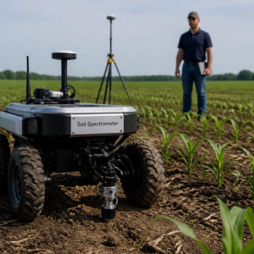
Advancements in soil analysis are transforming the agricultural landscape, enabling farmers to make data-driven decisions that significantly enhance productivity and sustainability. From field spectrometers to orbital sensors, the ability to monitor soil health has never been more precise, allowing for nuanced management strategies that were previously unimaginable.
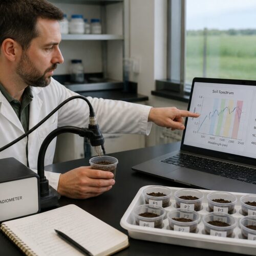
Soil spectroscopy, particularly through satellite technology, allows for the evaluation of critical soil properties remotely, which is a game-changer in modern agriculture. This technology is crucial for precision agriculture, helping optimize crop yields and sustainability by providing farmers with the information necessary to make informed decisions about their land management practices.
In this article, we will explore the various facets of soil analysis techniques, focusing on satellite soil monitoring and remote sensing, two areas that are rapidly evolving. Understanding these technologies can significantly enhance agricultural productivity and soil management practices, ultimately contributing to a more sustainable approach to food production.
From Field Spectrometers to Orbital Sensors: Scaling Up Soil Analysis
The transition from field spectrometers to orbital sensors marks a significant evolution in soil analysis, representing a leap in our ability to understand soil dynamics. While field spectrometers provide localized measurements that can be incredibly detailed, orbital sensors enable extensive and consistent monitoring across vast landscapes, allowing for a broader understanding of soil characteristics.
This scaling up allows for the analysis of soil properties on a continental scale, enabling better resource allocation and management strategies that can be tailored to specific regional needs. Additionally, the integration of satellite data enhances the understanding of soil variability over time and space, making it possible to track changes and respond proactively to emerging issues.
With satellite soil spectral indices, scientists can assess various soil characteristics, including moisture content and nutrient levels, which are essential for effective agricultural practices. This data is invaluable for farmers looking to optimize their practices based on precise soil information, thereby potentially increasing yield and ensuring sustainability.
Furthermore, satellite monitoring can identify areas of soil degradation or erosion, informing conservation efforts and enabling targeted interventions. The ability to visualize these changes in real-time allows for timely and effective responses to mitigate adverse effects on soil health and agricultural productivity.
Incorporating Earth observation into soil analysis not only provides a broader perspective but also supports sustainable agricultural practices by promoting informed decision-making. This comprehensive approach is essential for meeting the challenges of global food security, especially as the world grapples with increasing population and climate variability.
How Multispectral and Hyperspectral Satellites Differ for Soil Science
Multispectral and hyperspectral satellites are two key technologies used in soil science, each with unique capabilities that cater to different research needs. Multispectral satellites capture data across a few broad spectral bands, making them useful for general assessments, while hyperspectral satellites collect information across hundreds of narrow bands, allowing for a much more detailed analysis of soil composition.
This difference in data capture allows hyperspectral sensors to provide more detailed information about soil composition and health, enabling researchers to discern subtle variations in soil properties that multispectral sensors might miss. Consequently, hyperspectral sensors are often more effective for detecting specific minerals, organic matter content, and other critical soil characteristics that influence agricultural productivity.
For example, hyperspectral analysis can identify specific minerals and organic matter content in soil, which is crucial for understanding nutrient availability and soil fertility. In contrast, multispectral sensors are better suited for general assessments and monitoring larger areas efficiently, making them a practical choice for regional studies.
The choice between these technologies often depends on the specific needs of a project and the level of detail required for the analysis. Each type of sensor contributes valuable insights into soil health and management practices, and their combined use can enhance the overall understanding of soil ecosystems.
By leveraging both multispectral and hyperspectral data, researchers can create a more comprehensive understanding of soil ecosystems and their dynamics. This dual approach enhances satellite soil monitoring and improves agricultural outcomes, allowing for more effective resource management and crop planning.
Bare Soil Composite Imagery: Removing Vegetation for Clean Spectral Signals
Bare soil composite imagery is a critical technique in soil spectral analysis, as it helps isolate soil signals from vegetation interference, which can skew results. Removing vegetation allows for cleaner spectral signals that lead to more accurate assessments of soil properties, thereby enhancing the reliability of the data collected.
This technique is especially useful in regions with dense vegetation, where traditional satellite data can be obscured and difficult to interpret. By focusing on bare soil, researchers can obtain clearer readings of soil moisture and nutrient levels, which are vital for effective agricultural management.
| Soil Property | Multispectral Index | Hyperspectral Index |
|---|---|---|
| Moisture Content | Normalized Difference Vegetation Index (NDVI) | Water Index (WI) |
| Organic Matter | Soil Adjusted Vegetation Index (SAVI) | Soil Organic Matter Index (SOMI) |
| Soil Texture | Enhanced Vegetation Index (EVI) | Texture Index (TI) |
| Mineral Content | Normalized Burn Ratio (NBR) | Mineral Index (MI) |
The use of bare soil composite imagery can significantly improve the accuracy of satellite soil spectral indices, enabling researchers to make more reliable conclusions about soil health. By ensuring that vegetation does not interfere with soil readings, researchers can better estimate soil health and its capacity to support agricultural activities.
This approach is essential for effective soil monitoring and management strategies in precision agriculture, as it allows farmers to make informed decisions based on accurate data. The insights gained from clean spectral signals can lead to better crop management practices and more efficient resource allocation, ultimately enhancing productivity.
Key Satellite-Derived Indices Used to Estimate Soil Properties
Several satellite-derived indices play a crucial role in estimating soil properties, providing valuable insights for agricultural practices that can improve yield and sustainability. These indices utilize satellite soil spectral data to assess various aspects of soil health, including moisture content, organic matter levels, and nutrient availability.
Commonly used indices include the Normalized Difference Vegetation Index (NDVI) and the Soil Adjusted Vegetation Index (SAVI), each serving distinct purposes in soil analysis. These indices allow for a comprehensive analysis of soil conditions, enabling farmers and researchers to better understand the factors influencing crop health.
For instance, NDVI is primarily used to assess vegetation health but can also provide insights into soil moisture levels, making it an important tool for farmers. Meanwhile, SAVI is tailored to minimize the influence of soil brightness on vegetation measurements, making it ideal for areas with sparse vegetation and enabling accurate assessments of soil conditions.
Other important indices include the Enhanced Vegetation Index (EVI) and the Normalized Burn Ratio (NBR), each contributing to the understanding of soil properties like organic matter and nutrient content. By employing these satellite soil spectral indices, farmers and researchers can gain deeper insights into soil health and make informed decisions regarding crop management strategies.
The integration of these indices into precision agriculture practices enhances sustainability and productivity, ensuring that agricultural practices are grounded in reliable data. As a result, the application of satellite-derived indices is becoming increasingly essential for modern farming methodologies.
Validating Satellite Predictions Against Ground-Level Spectral Measurements
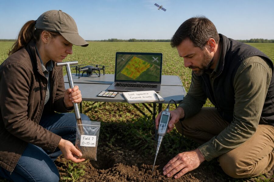
Validation of satellite predictions against ground-level spectral measurements is essential for ensuring the accuracy of soil assessments and enhancing the credibility of remote sensing technologies. By comparing satellite data with on-ground measurements, researchers can refine their models and improve predictive capabilities, leading to more effective agricultural practices.
This validation process helps identify discrepancies between satellite observations and actual soil conditions, providing critical feedback that can be used to enhance the reliability of satellite soil monitoring. As a result, it enhances the overall effectiveness of soil analysis, making it a vital component in precision agriculture.
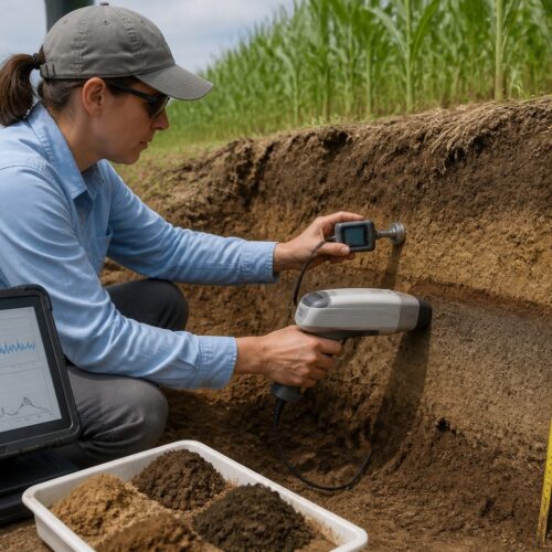
Ground-level measurements can include soil sampling, moisture content analysis, and nutrient profiling, which provide a benchmark against which satellite-derived predictions can be assessed. These on-the-ground data points are crucial for verifying the accuracy of satellite observations and ensuring that farmers receive reliable information about their soil conditions.
Through this process, researchers can also determine which satellite soil spectral indices best correlate with ground measurements, leading to improved calibration of satellite data. This insight is invaluable for calibrating satellite data and improving the accuracy and reliability of soil assessments, which are critical for effective agricultural management.
Ultimately, validating satellite predictions enhances the overall effectiveness of precision agriculture practices and allows farmers to make better-informed decisions regarding soil management and crop production. With accurate data, farmers can implement strategies that maximize yield while minimizing environmental impact, leading to more sustainable agricultural practices.
Temporal Monitoring of Soil Organic Carbon at Continental Scale
Temporal monitoring of soil organic carbon is vital for understanding soil health and carbon sequestration efforts, which are increasingly important in the context of climate change. Utilizing satellite technologies allows for the tracking of soil organic carbon changes over time at a continental scale, providing critical data for researchers and policymakers.
This monitoring is essential for assessing the impact of land use and agricultural practices on soil carbon levels, helping to identify trends and inform sustainable land management strategies. By analyzing trends in soil carbon, researchers can better inform policies aimed at promoting sustainable agriculture and mitigating climate change impacts.
- Earth observation data for carbon tracking, enabling informed decision-making
- Assessment of land use impacts on soil carbon levels, fostering sustainable practices
- Long-term soil health monitoring to track changes and implement corrective measures
- Support for carbon offset initiatives, promoting environmental stewardship
- Integration with climate change strategies to enhance resilience in agricultural systems
Through temporal monitoring, it becomes possible to identify areas of soil degradation and implement corrective measures that can enhance soil health. This proactive approach to soil management is essential for maintaining healthy agricultural systems that can withstand the challenges posed by climate variability and human activity.
The insights gained from monitoring soil organic carbon can significantly influence agricultural practices and policy-making, leading to more effective strategies for enhancing soil health. By prioritizing soil health and carbon sequestration, we can contribute to both environmental sustainability and food security, ensuring a resilient future for agriculture.
Data Fusion: Combining Sentinel, Landsat and DESIS for Soil Mapping
Data fusion techniques are revolutionizing soil mapping by combining data from multiple satellite sources, allowing for a more comprehensive understanding of soil characteristics across diverse landscapes. By integrating information from Sentinel, Landsat, and DESIS, researchers can achieve more accurate and detailed soil assessments that enhance the effectiveness of precision agriculture practices.
This combination of satellite soil spectral indices enhances the spatial resolution and reliability of soil data, enabling more precise decision-making in agricultural practices. Consequently, it allows for improved crop management strategies that are rooted in reliable and timely information about soil health.
Utilizing data from Sentinel satellites provides high-resolution imagery that is essential for local assessments, while Landsat offers long-term historical data that helps track changes over time. In contrast, DESIS specializes in hyperspectral imaging, delivering detailed spectral information for soil analysis that can reveal intricate details about soil composition and health.
By fusing these datasets, researchers can create comprehensive soil maps that reflect current conditions and trends, which is invaluable for effective land management. This approach enables more effective monitoring of soil health and informs precision agriculture initiatives that aim to enhance productivity while minimizing environmental impact.
Ultimately, data fusion is a powerful tool for enhancing satellite soil monitoring capabilities and improving the overall quality of soil assessments. This technique not only improves soil mapping but also supports sustainable agricultural practices through better resource management, ensuring that farmers can respond effectively to changing conditions.
Access and Processing Platforms for Agricultural Soil Remote Sensing
Accessing and processing satellite data for agricultural soil remote sensing is crucial for effective analysis and informed decision-making in farming practices. Several platforms are available that facilitate the retrieval and processing of satellite imagery for soil analysis, making it easier for researchers and farmers to leverage these advanced technologies.
Popular platforms include Google Earth Engine, NASA’s Earthdata, and Sentinel Hub, each offering unique features that cater to different user needs. These platforms provide user-friendly interfaces and robust tools for analyzing satellite soil spectral indices, which simplifies the process for users who may not have extensive technical expertise.
Additionally, many platforms provide tutorials and documentation to assist users in navigating the complexities of remote sensing data, empowering them to utilize these tools effectively. This accessibility is crucial for ensuring that researchers and farmers alike can make informed decisions based on accurate satellite-derived data.
By utilizing these platforms, users can access a wealth of satellite data for soil monitoring and management, which is essential for making informed decisions regarding crop health and soil conservation. This data is invaluable for optimizing agricultural practices and enhancing overall productivity while maintaining sustainability.
As remote sensing technology continues to advance, these platforms are expected to evolve further, offering enhanced capabilities and features that will improve the user experience. Enhanced processing capabilities will likely improve the accuracy and efficiency of soil analysis, benefiting the agriculture sector and contributing to more sustainable practices.
Limitations of Satellite Soil Spectroscopy and How Research Is Addressing Them
While satellite soil spectroscopy offers numerous benefits, it also has its limitations that can impact the accuracy and reliability of soil assessments. Factors such as atmospheric interference, spatial resolution, and data interpretation challenges can affect the precision of the soil data collected, making it essential to address these issues through ongoing research and development.
Research is actively addressing these limitations through improved algorithms and data processing techniques that enhance the quality of satellite soil spectral indices. By enhancing satellite soil spectral indices and refining validation methods, scientists are working to increase the precision of soil monitoring, ensuring that farmers and researchers can trust the data they rely on.
Furthermore, ongoing advancements in satellite technology, including higher resolution sensors and improved data processing capabilities, promise to mitigate some of these challenges. These improvements will enhance the overall effectiveness of satellite soil monitoring, making it an even more valuable tool for modern agriculture.
Additionally, interdisciplinary collaboration among soil scientists, remote sensing experts, and data analysts is vital for overcoming existing hurdles and developing innovative solutions. By sharing knowledge and resources, the agricultural community can make significant strides in soil health management and contribute to sustainable agriculture.
Ultimately, addressing these limitations will lead to more accurate and reliable satellite soil monitoring, which is essential for promoting sustainable agricultural practices and ensuring food security worldwide. As the technology continues to evolve, the potential for satellite soil analysis to contribute to agricultural productivity and environmental stewardship will only increase.