
Precision agriculture is revolutionizing how we manage crops and soil. One of the most promising technologies in this field is soil spectroscopy soil mapping, which allows for rapid and cost-effective analysis of soil properties.
By understanding the spatial variability of soil characteristics, farmers can optimize their inputs, reduce environmental impact, and increase yields. This article will explore how soil spectroscopy and spectral imaging can be used to create detailed soil maps, and how these maps can be applied in agricultural management.
We’ll also examine real-world case studies to demonstrate the power of this technology. Let’s see how geospatial analysis can transform the way we approach farming.
The Basics of Soil Mapping with Soil Spectroscopy
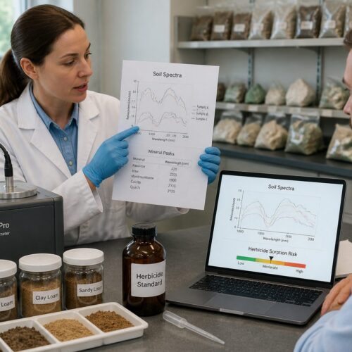
Soil spectroscopy is a technique that measures the interaction of electromagnetic radiation with soil samples. When light interacts with soil, certain wavelengths are absorbed or reflected depending on the chemical and physical properties of the soil.
By analyzing the resulting spectrum, we can infer the composition of the soil, including its mineral content, organic matter content, moisture levels, and other important parameters. This information is invaluable for creating accurate soil maps.
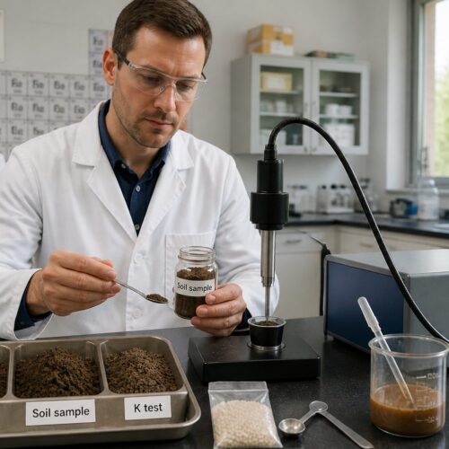
Traditional soil mapping methods involve collecting soil samples at various locations and sending them to a laboratory for analysis. This process can be time-consuming and expensive, limiting the number of samples that can be analyzed and the resolution of the resulting soil map.
Soil spectroscopy offers a faster and more cost-effective alternative, allowing for the analysis of a larger number of samples and the creation of high-resolution soil maps. The technology relies on the principle that different soil components absorb and reflect light at specific wavelengths.
This allows for a non-destructive analysis of the soil, preserving the sample for other potential analyses. The reflected light is measured by a spectrometer, which generates a spectral signature unique to that soil sample.
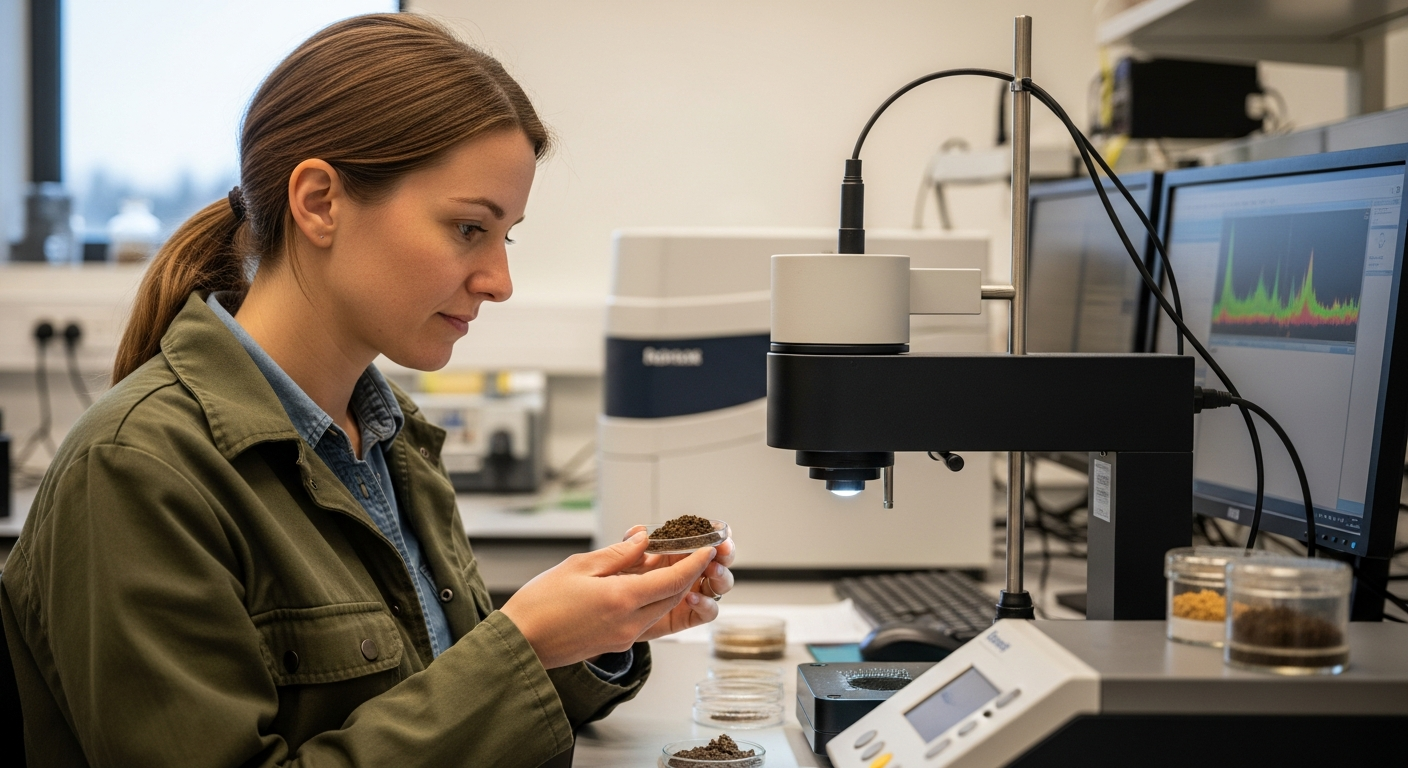
These spectral signatures can then be compared to reference libraries to identify soil components and their concentrations. The use of soil spectroscopy can significantly reduce the time and cost associated with traditional soil analysis methods.
Furthermore, it allows for a more comprehensive understanding of soil variability across a field. This understanding is crucial for effective precision agriculture practices.
The benefits of using soil spectroscopy extend beyond cost and time savings, offering a more holistic approach to soil management. It provides a foundation for informed decision-making regarding fertilizer application, irrigation, and other agricultural practices.
Collecting and Processing Spectral Data for Soil Mapping
The first step in soil mapping with soil spectroscopy is to collect spectral data from soil samples. This can be done using a variety of instruments, including handheld spectrometers, laboratory spectrometers, and airborne or satellite-based spectral sensors.
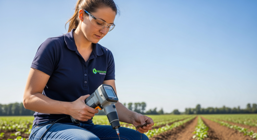
Handheld spectrometers are portable devices that can be used to collect spectral data in the field. These devices are useful for collecting data from a limited number of locations, but they can be time-consuming to use for large areas.
Laboratory spectrometers are more accurate than handheld spectrometers, but they require soil samples to be transported to a laboratory for analysis. Airborne and satellite-based spectral sensors can collect spectral data over large areas quickly and efficiently.
These sensors measure the reflectance of the soil surface at different wavelengths. Once the spectral data has been collected, it needs to be pre-processed to remove noise and correct for atmospheric effects.
The choice of instrument depends on the scale of the mapping project and the desired level of accuracy. For small-scale projects, handheld spectrometers can be a cost-effective option.
However, for large-scale projects, airborne or satellite-based sensors are more efficient. Regardless of the instrument used, it is important to collect a representative sample of soil from the area being mapped.
This involves collecting samples from different locations and depths, and ensuring that the samples are free from contamination. The collected spectral data is then processed using specialized software to remove noise and correct for atmospheric effects.
This pre-processing step is crucial for ensuring the accuracy of the resulting soil map. The pre-processed data is then used to create a spectral library, which is a collection of spectral signatures that are representative of different soil types.
Spectral Pre-processing Techniques
Several pre-processing techniques can be used to improve the quality of spectral data. These include smoothing, which reduces noise in the spectrum, and normalization, which corrects for variations in illumination and sensor sensitivity.
Another important pre-processing step is spectral calibration, which involves relating the spectral data to known soil properties. This is typically done by collecting a set of soil samples and analyzing them in the laboratory to determine their chemical and physical properties.
| Pre-processing Technique | Description | Purpose |
|---|---|---|
| Smoothing | Averages spectral data points | Reduces noise |
| Normalization | Scales spectral data to a common range | Corrects for variations in illumination |
| Spectral Calibration | Relates spectral data to known soil properties | Enables prediction of soil properties from spectral data |
| Atmospheric Correction | Removes atmospheric effects from spectral data | Improves accuracy of spectral data |
The spectral data is then used to develop a calibration model that can be used to predict soil properties from spectral data. Once the spectral data has been pre-processed and calibrated, it can be used to create soil maps.
This involves using statistical techniques to interpolate the spectral data between sampling locations and create a continuous map of soil properties. The accuracy of the resulting soil map depends on the quality of the spectral data, the accuracy of the calibration model, and the density of the sampling locations.
Smoothing techniques, such as moving average filters, help to reduce random noise in the spectral data. Normalization methods, like standard normal variate (SNV) transformation, minimize the effects of particle size and scattering.
Spectral calibration involves establishing a relationship between spectral reflectance and soil properties through statistical models. These models are often developed using partial least squares regression (PLSR) or other multivariate analysis techniques.
Atmospheric correction is crucial when using airborne or satellite-based spectral data. It removes the effects of atmospheric absorption and scattering, ensuring that the spectral data accurately reflects the soil surface.
Integrating Spectroscopy Data with GIS Software
Geographic Information System (GIS) software is essential for creating and analyzing soil maps. GIS software allows for the integration of spectral data with other spatial data, such as topography, land cover, and climate data.
This integration enables the creation of comprehensive soil maps that can be used for a variety of applications. One of the key functions of GIS software is the ability to georeference spectral data.
Georeferencing involves assigning geographic coordinates to the spectral data, so that it can be accurately located on a map. This is typically done using GPS or other positioning technologies.
Once the spectral data has been georeferenced, it can be imported into GIS software and overlaid with other spatial data layers. GIS software also provides a variety of tools for analyzing spectral data and creating soil maps.
These tools include interpolation techniques, which are used to estimate soil properties between sampling locations, and classification techniques, which are used to group soils into different classes based on their properties. GIS software also allows for the creation of thematic maps, which display the spatial distribution of different soil properties.
Common GIS software packages used for soil mapping include ArcGIS, QGIS, and ENVI. These software packages provide a range of tools for data visualization, analysis, and mapping.
The integration of spectral data with other spatial data layers allows for a more holistic understanding of soil properties and their relationship to other environmental factors. For example, integrating soil maps with topographic data can help to identify areas that are prone to soil erosion.
Integrating soil maps with climate data can help to identify areas that are suitable for different types of crops. GIS software also allows for the creation of custom maps that are tailored to specific needs.
Creating Detailed Soil Maps for Precision Agriculture
The ultimate goal of soil spectroscopy soil mapping is to create detailed soil maps that can be used for precision agriculture. These maps provide valuable information about the spatial variability of soil properties, allowing farmers to optimize their inputs and management practices.
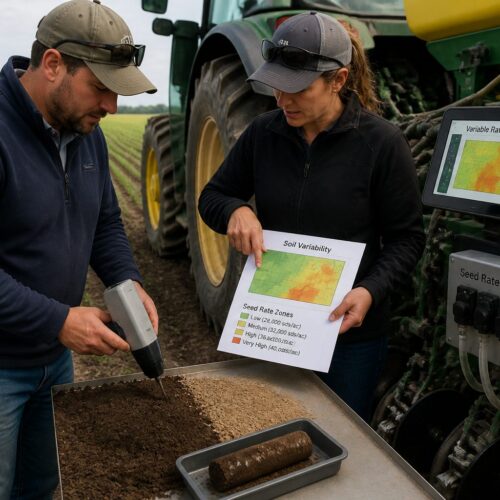
One of the key applications of soil maps in precision agriculture is variable rate fertilization. Variable rate fertilization involves applying different amounts of fertilizer to different parts of a field, based on the soil’s nutrient content.
Soil maps can be used to identify areas of the field that are deficient in certain nutrients, allowing farmers to apply more fertilizer to those areas and less fertilizer to areas that have adequate nutrient levels. This can improve crop yields and reduce fertilizer costs.
Soil maps can also be used to optimize irrigation practices. By understanding the soil’s water-holding capacity, farmers can apply water more efficiently, reducing water waste and improving crop yields.
Detailed soil maps can also guide the placement of drainage systems, improving water management and reducing the risk of waterlogging. Furthermore, they can be used to identify areas with specific soil constraints, such as high salinity or acidity, allowing for targeted remediation efforts.
The creation of these maps often involves a combination of field sampling, spectral analysis, and geostatistical modeling. The accuracy of the maps is crucial for effective precision agriculture practices.
Therefore, it is important to use appropriate sampling strategies and calibration techniques. Farmers can use these maps to make informed decisions about fertilizer application, irrigation, and other management practices, leading to increased efficiency and profitability.
Precision agriculture aims to optimize resource use and minimize environmental impact, and detailed soil maps are a key component of this approach. By understanding the spatial variability of soil properties, farmers can tailor their management practices to the specific needs of each area of the field.
Applications of Soil Maps in Agricultural Management
Soil maps have a wide range of applications in agricultural management, beyond variable rate fertilization and irrigation. They can also be used to optimize planting densities, select appropriate crop varieties, and manage soil erosion.
By understanding the soil’s physical and chemical properties, farmers can choose crop varieties that are best suited to the soil conditions. Soil maps can also be used to identify areas of the field that are prone to soil erosion.
- Variable rate fertilizer application
- Targeted irrigation management
- Optimized planting densities
- Selection of appropriate crop varieties
- Soil erosion management strategies
This allows farmers to implement soil conservation practices, such as terracing or cover cropping, to reduce soil loss. Another important application of soil maps is in land use planning.
Soil maps can be used to identify areas that are suitable for different types of agriculture, such as crop production, grazing, or forestry. This can help to ensure that land is used sustainably and that agricultural practices are appropriate for the soil conditions.
Soil maps can assist in predicting crop yields based on soil characteristics and historical data. This allows farmers to make informed decisions about crop selection and management strategies.
They are also crucial for assessing the suitability of land for specific agricultural activities, such as organic farming or intensive livestock grazing. Understanding soil properties can help prevent land degradation and promote sustainable agricultural practices.
Furthermore, soil maps can be used to monitor changes in soil properties over time, allowing farmers to adapt their management practices to changing conditions. This is particularly important in the context of climate change, which can significantly impact soil health and productivity.
Case Studies: Successful Soil Mapping Projects
Several successful soil mapping projects have demonstrated the power of soil spectroscopy and spectral imaging in precision agriculture. One example is a project conducted in the Midwestern United States, where soil spectroscopy was used to create detailed soil maps for corn and soybean production.
The soil maps were used to guide variable rate fertilization, resulting in increased crop yields and reduced fertilizer costs. Another example is a project conducted in Australia, where airborne spectral sensors were used to map soil salinity in wheat-growing regions.
The soil maps were used to identify areas of the field that were affected by salinity, allowing farmers to implement targeted management practices to reduce the impact of salinity on crop yields. In California, soil spectroscopy has been used to map soil organic matter in vineyards.
These maps help growers optimize irrigation and fertilization, leading to improved grape quality and water use efficiency. These case studies show that soil spectroscopy soil mapping can be a valuable tool for improving agricultural management and promoting sustainable farming practices.
In Brazil, researchers have used soil spectroscopy to map soil fertility in sugarcane plantations. This has allowed for targeted fertilizer application, resulting in increased sugarcane yields and reduced environmental impact.
A project in Europe utilized soil spectroscopy to assess soil carbon sequestration potential in agricultural lands. The resulting maps helped to identify areas where soil carbon sequestration could be enhanced through specific management practices.
In Africa, soil spectroscopy has been used to map soil nutrient deficiencies in smallholder farms. This has enabled farmers to apply targeted fertilizer interventions, leading to improved crop yields and food security.
These case studies highlight the versatility of soil spectroscopy in addressing a wide range of agricultural challenges. The technology can be adapted to different crops, soil types, and farming systems, making it a valuable tool for promoting sustainable agriculture worldwide.
Challenges and Future Trends in Soil Spectroscopy
While soil spectroscopy holds great promise for precision agriculture, there are still some challenges that need to be addressed. One of the main challenges is the cost of spectral sensors and data processing.
While the cost of these technologies has decreased in recent years, it can still be a barrier for some farmers. Another challenge is the complexity of spectral data analysis.
Analyzing spectral data requires specialized knowledge and skills, which may not be readily available to all farmers. Despite these challenges, the future of soil spectroscopy soil mapping looks bright.
Advances in sensor technology and data processing techniques are making it easier and more affordable to create detailed soil maps. One trend is the development of more portable and affordable spectral sensors.
The development of robust and accurate calibration models remains a key challenge. These models need to be able to account for the complex interactions between soil properties and spectral reflectance.
Another challenge is the need for standardized protocols for data collection and processing. This would ensure that soil maps are comparable across different regions and farming systems.
Future trends in soil spectroscopy include the development of more sophisticated data analytics techniques, such as machine learning and artificial intelligence. These techniques can be used to extract more information from spectral data and create more accurate soil maps.
The integration of soil spectroscopy with other precision agriculture technologies, such as drones and sensors, is also expected to increase in the future. This will allow for the creation of more comprehensive and integrated decision support systems for farmers.
Advancements in Sensor Technology
These sensors can be used to collect spectral data in the field quickly and easily. Another trend is the development of more sophisticated data processing techniques.
These techniques can be used to extract more information from spectral data and create more accurate soil maps. Machine learning algorithms are being used to improve the accuracy of spectral calibration models.
These algorithms can learn from large datasets of spectral data and soil properties, allowing for the creation of more accurate and robust calibration models. Another trend is the integration of soil spectroscopy with other precision agriculture technologies.
This integration allows for the creation of comprehensive decision support systems that can help farmers optimize their management practices. Soil spectroscopy is being combined with remote sensing data, such as satellite imagery, to create more detailed and accurate soil maps.
Miniaturization of sensors is leading to the development of smaller, more portable, and less expensive devices. This makes soil spectroscopy more accessible to a wider range of users.
Improvements in sensor sensitivity and spectral resolution are enhancing the accuracy and detail of soil maps. New sensor technologies, such as hyperspectral imaging, are providing even more detailed information about soil properties.
The development of wireless sensor networks is enabling real-time monitoring of soil properties. This allows farmers to make more timely and informed decisions about their management practices.
Advancements in sensor technology are also facilitating the development of automated soil mapping systems. These systems can collect and process spectral data autonomously, reducing the need for manual labor and expertise.
Conclusion
Soil spectroscopy and spectral imaging offer a powerful tool for creating detailed soil maps that can be used for precision agriculture. By understanding the spatial variability of soil properties, farmers can optimize their inputs, reduce environmental impact, and increase yields.
While there are still some challenges that need to be addressed, the future of soil spectroscopy soil mapping looks bright. Advances in sensor technology and data processing techniques are making it easier and more affordable to create detailed soil maps, paving the way for more sustainable and efficient agricultural practices.
The integration of soil spectroscopy with other precision agriculture technologies will further enhance its value. As the technology continues to evolve, it is likely to play an increasingly important role in promoting sustainable agriculture and ensuring food security.
By embracing soil spectroscopy and spectral imaging, farmers can gain a deeper understanding of their soil resources. This understanding will enable them to make more informed decisions and manage their land more effectively, leading to improved productivity and environmental stewardship.
Ultimately, soil spectroscopy soil mapping represents a significant step forward in our ability to manage and protect our soil resources. It offers a pathway towards a more sustainable and resilient agricultural future.