
Precision agriculture promises to revolutionize farming by tailoring practices to specific field conditions, moving beyond broad-brush approaches. However, truly understanding the soil beneath our feet requires more than just a quick look. It demands a detailed, multi-dimensional view of its complex characteristics.
Traditional soil sampling provides valuable snapshots but lacks the spatial resolution needed for precise management zones. This is where advanced sensor technologies step in, offering continuous, high-density data collection that maps variability across a field. The real power comes from combining these insights.
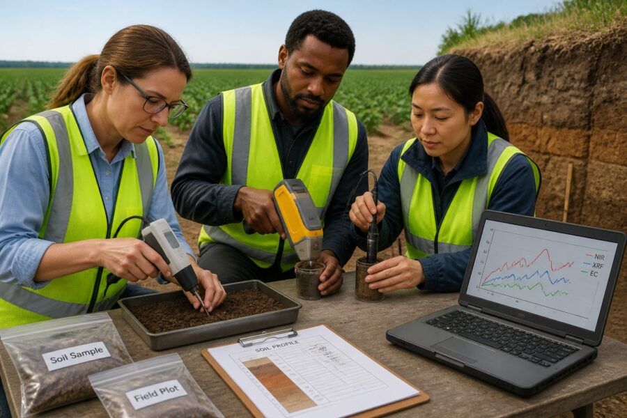
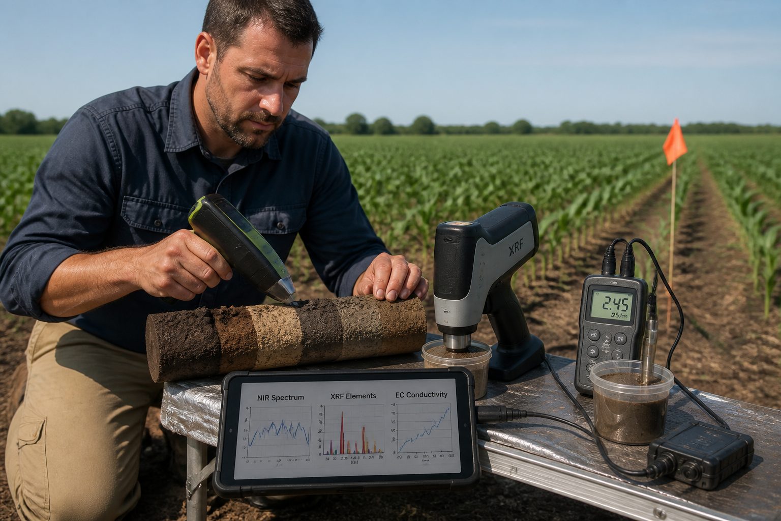
This article explores the exciting potential of multisensor fusion NIR XRF EC soil profiles, integrating near-infrared spectroscopy, X-ray fluorescence, and electrical conductivity data. This combined approach paints a far richer picture of soil health and nutrient status than any single sensor can achieve alone.
Why No Single Sensor Captures the Full Soil Picture
Soil is an incredibly complex system, with physical, chemical, and biological properties constantly interacting and changing. A single sensor, no matter how advanced, can only ever measure a subset of these properties. This means any lone data stream provides an incomplete story.
For instance, an electrical conductivity sensor tells us about salinity and texture, but it says nothing directly about organic carbon content. A near-infrared spectrometer excels at predicting organic matter and moisture, yet it can’t identify specific elemental concentrations. Each instrument has its strengths and limitations.
Relying on one data type means making management decisions with significant blind spots. Farmers might optimize for nitrogen based on one map, only to find another nutrient is deficient, limiting the plant’s uptake of that nitrogen. This leads to inefficient resource use and suboptimal yields.
The inherent variability of soil across even small fields further complicates matters for individual sensors. Soil properties like pH, bulk density, and nutrient levels can change dramatically over just a few meters. Capturing this nuance demands a comprehensive data approach.
Think of it like trying to diagnose a patient with only a thermometer; you get temperature, but you miss blood pressure, heart rate, and countless other vital signs. A comprehensive diagnosis requires multiple measurements that build a complete health profile. Soil is no different.
Different soil properties also influence each other in intricate ways, making isolated measurements less informative. For example, soil texture affects water holding capacity, which impacts nutrient mobility, which then influences microbial activity. These connections are lost when data is siloed.
Traditional soil testing, while precise, offers limited spatial resolution and comes with significant time delays. Sensors provide real-time, high-density data, but they need to work together to overcome their individual shortcomings. This is why multisensor fusion NIR XRF EC soil profiles are so compelling.
A single sensor might provide a proxy for a property, but combining data from several sources often yields a direct measurement or a much more accurate prediction. This helps reduce the uncertainty inherent in any indirect sensing technique. Getting closer to the truth on the ground is always the goal.
Furthermore, the cost of collecting traditional samples and laboratory analysis can be prohibitive for high-resolution mapping. Sensors offer a more economically feasible path to detailed soil characterization, especially when deployed efficiently. Scaling up data collection becomes much more practical with sensor technology.
Ultimately, a farmer needs to understand the full nutrient and physical profile of their soil to make truly informed decisions. Relying on just one piece of the puzzle leaves too much to chance. This holistic understanding is precisely what multisensor fusion aims to deliver.
What NIR, XRF, and EC Each Measure and Where They Overlap
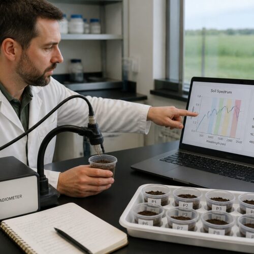
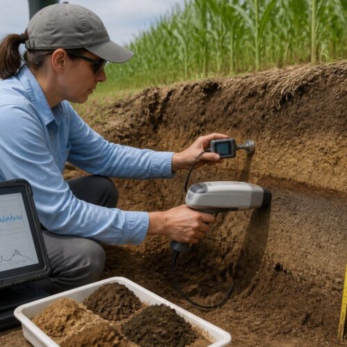
Near-Infrared (NIR) spectroscopy measures the absorption of light in the near-infrared spectrum, providing insights into organic matter, moisture content, and soil texture. It excels at quickly characterizing bulk properties related to soil carbon and water dynamics. X-ray Fluorescence (XRF) spectrometry, on the other hand, identifies and quantifies elemental concentrations in the soil, giving direct readings for essential nutrients like phosphorus, potassium, calcium, and micronutrients, as well as heavy metals.
Electrical Conductivity (EC) measures how easily electrical current passes through the soil, which correlates with soil salinity, clay content, and soil moisture levels. While each sensor offers unique information, they also share some common ground, often providing complementary or corroborating data points for certain soil characteristics. This overlap strengthens the overall data picture.
| Sensor Technology | Primary Measurements | Key Overlaps / Complementary Data |
|---|---|---|
| Near-Infrared (NIR) | Organic Matter, Soil Moisture, Clay/Sand/Silt Content, Cation Exchange Capacity (indirect) | Soil texture (with EC), nutrient proxies (with XRF), general soil health |
| X-ray Fluorescence (XRF) | Elemental Concentrations (P, K, Ca, Mg, Fe, Zn, Cu, Mn, Al, Si), Heavy Metals | Specific nutrient levels (informs NIR organic matter quality), soil parent material |
| Electrical Conductivity (EC) | Soil Salinity, Clay Content, Soil Moisture, Bulk Density (indirect) | Soil texture (with NIR), water movement, nutrient availability (affected by salinity) |
| Multisensor Fusion | Comprehensive Soil Profiles, Enhanced Nutrient Mapping, Improved Soil Health Indicators, Precision Zone Delineation | All properties synergized for higher accuracy and predictive power |
Data Fusion Approaches: Decision-Level vs. Feature-Level Integration
When combining data from multiple sensors, researchers typically employ different data fusion strategies, each with its own advantages and challenges. The two main categories are decision-level fusion and feature-level fusion, representing distinct points in the data processing pipeline. Understanding these methods helps in building robust `sensor fusion soil analysis` systems.
Decision-level fusion involves processing data from each sensor independently to derive separate predictions or classifications. These individual “decisions” are then combined using a higher-level algorithm, such as weighted averaging, voting, or fuzzy logic. This approach is often simpler to implement because it treats each sensor’s output as a black box.
A farmer might use NIR data to predict organic carbon and XRF data to predict phosphorus, then combine these two predictions with EC data to determine a fertilizer prescription. The final action is a result of integrating these separate conclusions. This method allows for flexibility in using different models for different sensor types.
Feature-level fusion, on the other hand, integrates the raw or pre-processed data from all sensors much earlier in the analytical process. This means combining the spectral curves from NIR, the elemental intensities from XRF, and the EC readings into a single, comprehensive dataset. This larger dataset then feeds into a single, more complex machine learning model.
This approach allows the model to identify subtle correlations and interactions between different sensor outputs that might not be apparent when processed separately. For example, a slight shift in an NIR spectrum might only become meaningful in combination with a specific elemental concentration from XRF. The model learns these relationships itself.
Feature-level fusion often leads to higher prediction accuracy because it leverages the full information content of the combined data. The model has a broader context to draw upon when making its predictions. However, it also requires more sophisticated algorithms and a larger, more carefully aligned dataset for training.
The choice between decision-level and feature-level fusion depends on several factors, including the nature of the soil properties being predicted and the available computational resources. Decision-level fusion offers robustness and modularity, while feature-level fusion typically offers superior performance. Both have a place in `combined spectroscopy EC mapping`.
Hybrid approaches also exist, combining elements of both strategies. One might perform some initial feature extraction from each sensor, then combine these extracted features before a final modeling step. This balances the complexity and performance trade-offs inherent in fusion. It tries to get the best of both worlds.
Regardless of the chosen approach, the goal remains the same: to extract the maximum possible information from the `multi-instrument soil data` to create more accurate and reliable soil maps. This empowers farmers to make better, more targeted management decisions. The fusion process creates a synergy where the whole is greater than the sum of its parts.
Implementing these fusion techniques requires expertise in data science and machine learning. It is not simply about stacking data but about intelligently combining it to reveal hidden patterns. Proper validation of fusion models is also crucial to ensure their real-world applicability and reliability in diverse agricultural settings.
Practical Field Setup for Simultaneous or Sequential Multi-Sensor Scanning
Deploying multiple soil sensors in the field for precision agriculture mapping presents practical challenges that demand careful planning and execution. The setup can involve either simultaneous data collection, where all sensors operate at once, or sequential scanning, where sensors are used in separate passes. Each method has specific logistical considerations.
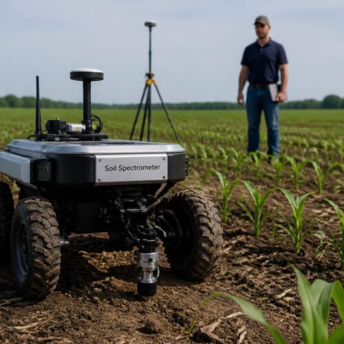
Simultaneous scanning typically involves mounting all sensors onto a single platform, often a tractor-drawn cart or an ATV. This integrated approach ensures perfect spatial alignment of all data points, as every sensor measures the exact same location at the same time. This simplifies the data alignment process significantly later on.
These integrated platforms often include a high-precision GPS unit to accurately georeference all sensor readings. This accurate positioning is absolutely necessary for creating precise soil maps and for subsequent variable rate application. Without good GPS, the data becomes much less useful for precision management.
Designing such a multi-sensor rig requires engineering expertise to ensure stable mounting, appropriate power supply, and data logging capabilities for each instrument. The sensors must be positioned to avoid interference with each other. This often means careful spacing and shielding. It is not just about bolting them on.
Sequential scanning, in contrast, involves making separate passes over the field with different sensors. For example, one pass might collect EC data, and a second pass might collect NIR and XRF data. This can be simpler to implement if integrated platforms are not readily available or are too costly.
The main challenge with sequential scanning is maintaining precise spatial alignment between the different data sets. Even small deviations in driving paths between passes can lead to significant misalignment in the resulting maps. High-accuracy GPS and consistent driving patterns become even more important here.
Regardless of the setup, proper calibration of each sensor is absolutely fundamental. Sensors drift over time and require regular checks against known standards to ensure accuracy. This is not a one-time task but an ongoing maintenance requirement for reliable `multi-instrument soil data`.
Environmental factors like soil moisture content, surface roughness, and crop residue can also affect sensor readings. Operators need training to understand these influences and to know when conditions are optimal for data collection. Dry, uniform conditions are often best for consistent results.
Data logging systems must be robust enough to handle the high volume of information generated by multiple sensors operating continuously. This means reliable storage, efficient transfer, and clear timestamping for every reading. Losing data in the field is a costly mistake.
The overall goal is to collect comprehensive, accurate, and spatially aligned data with minimal operational overhead. Whether through integrated systems or careful sequential passes, the field setup is a critical step in building effective `multisensor fusion NIR XRF EC soil profiles` for precision agriculture. Getting this right makes all the difference.
How Fusion Improves Prediction Accuracy for Key Soil Properties
Combining data from NIR, XRF, and EC sensors significantly boosts the accuracy and reliability of predicting crucial soil properties compared to using any single sensor alone. This `sensor fusion soil analysis` creates a more robust foundation for precision agriculture decisions. It addresses the inherent limitations of individual technologies.
For example, NIR might estimate organic matter, but XRF can provide specific elemental data related to carbon cycling, like nitrogen or sulfur, which strengthens the organic matter prediction. EC data adds context about soil texture and salinity, further refining how organic matter might behave in that specific soil environment. This layered information paints a much clearer picture.
- More accurate organic carbon mapping
- Improved prediction of available phosphorus
- Better estimation of potassium levels
- Enhanced cation exchange capacity (CEC) modeling
- Precise soil texture classification
- Reliable pH mapping across fields
- Better understanding of water holding capacity
- Accurate delineation of salinity zones
- Robust heavy metal contamination detection
- Refined soil health scores for management zones
Processing and Storing Multi-Sensor Datasets Without Losing Alignment
Managing `multi-instrument soil data` from diverse sensors presents a unique set of challenges related to processing, storage, and ensuring data integrity. The sheer volume and variety of information demand a structured approach to prevent misalignment and data loss. This is not a trivial task for any farm or research institution.
The first step in processing is often data cleaning and noise reduction for each individual sensor stream. Raw sensor data can contain outliers, spikes, or gaps that need to be addressed before fusion. This pre-processing ensures that only high-quality information contributes to the final analysis.
Georeferencing is absolutely critical; every data point from every sensor must be accurately tagged with its precise geographic coordinates. High-precision GPS units are essential for this, allowing all data layers to be stacked and analyzed in their correct spatial context. Without this, the data is just a jumble.
Synchronization also plays a major role, particularly in simultaneous scanning setups. All sensor readings need to be timestamped and aligned to ensure they correspond to the same physical location at the same moment. This temporal alignment is just as important as spatial alignment for `sensor fusion soil analysis`.
Once individual sensor data streams are cleaned and aligned, they need to be integrated into a common format or database structure. This might involve creating a single table where each row represents a sampling point, and columns hold the corresponding readings from NIR, XRF, and EC. This unified structure is key.
Relational databases or specialized geospatial databases are often used to store these complex datasets. These systems allow for efficient querying, analysis, and visualization of the integrated information. They are built to handle the scale and relationships within the data.
Data interpolation and gridding techniques are often applied to create continuous maps from discrete sensor readings. This involves estimating soil properties at unmeasured locations based on surrounding data points. This creates the smooth maps that precision agriculture relies on.
Version control for these datasets is also important, especially as new data is collected or processing algorithms are refined. Knowing which version of a map or dataset was used for a particular decision helps maintain traceability and accountability. This helps avoid confusion down the line.
Long-term storage solutions must be robust and scalable, accommodating years of `multisensor fusion NIR XRF EC soil profiles` data for a farm. Cloud-based storage offers flexibility and accessibility, while local servers provide control and security. A hybrid approach often balances these needs effectively.
Finally, data visualization tools are essential for making sense of the complex fused datasets. Interactive maps, charts, and dashboards allow agronomists and farmers to explore the data, identify patterns, and make informed decisions. Turning raw numbers into actionable insights is the ultimate goal of all this processing.
Cost-Benefit Analysis: Is the Added Complexity Worth It?
Adopting `multisensor fusion NIR XRF EC soil profiles` undeniably introduces more complexity and a higher initial investment compared to single-sensor approaches or traditional methods. Farmers and agricultural businesses need to carefully weigh these costs against the potential benefits and return on investment. It is a significant decision for any operation.
The upfront costs include purchasing multiple sophisticated sensors, an integrated platform for simultaneous scanning, high-precision GPS, and robust data logging hardware. There is also the expense of specialized software for data fusion, mapping, and analysis. These are not cheap components.
Beyond hardware and software, there is a substantial investment in human capital. Operators need training on how to properly deploy, calibrate, and maintain the equipment. Agronomists and data analysts require skills in interpreting fused datasets and developing predictive models for `combined spectroscopy EC mapping`.
The time commitment for data collection, processing, and model development is also higher initially. It takes effort to set up the systems, learn the workflows, and refine the models to suit specific farm conditions. This is not an instantaneous solution but a long-term investment.
However, the benefits of this `sensor fusion soil analysis` can be profound and quickly outweigh the initial complexities. The most significant advantage is the dramatically improved accuracy of soil property maps. This precision directly translates into more efficient use of inputs like fertilizer, lime, and water.
By applying nutrients only where they are needed and in the correct amounts, farmers can reduce input costs, minimize environmental impact from runoff, and optimize crop health. This leads to higher yields and better quality produce, boosting overall profitability. Every dollar saved on inputs and every bushel gained goes straight to the bottom line.
More accurate soil maps also allow for targeted soil amendments, correcting specific deficiencies or excesses with surgical precision. This helps build healthier, more resilient soils over the long term. Improving soil health is a continuous process, and precise data makes it much more effective.
The ability to identify and manage within-field variability at a fine scale helps farmers move from field-level averages to sub-field management zones. This unlocks the true potential of variable rate technology. It allows for a customized approach to every square meter of the farm.
For large-scale operations or those managing high-value crops, the incremental gains in yield and efficiency from `multisensor fusion NIR XRF EC soil profiles` can quickly generate a substantial return on investment. The cost savings on inputs alone can be enough to justify the expenditure within a few seasons. The numbers often speak for themselves.
Ultimately, the added complexity is worth it for farms committed to maximizing productivity, sustainability, and profitability through data-driven decisions. The future of precision agriculture clearly points towards more integrated, comprehensive soil sensing. Early adopters will gain a competitive edge in a demanding market.
Multisensor fusion, specifically integrating NIR, XRF, and EC data, represents a powerful leap forward in understanding soil dynamics for precision agriculture. It moves beyond the limitations of single-sensor approaches, delivering a comprehensive and accurate view of soil properties that was previously unattainable. This combined data empowers farmers and agronomists to make smarter, more targeted decisions regarding nutrient management, water use, and overall soil health, driving both profitability and environmental stewardship.