
Soil salinity poses a significant threat to agricultural productivity worldwide. It reduces crop yields and limits the availability of arable land.
Traditional methods of salinity detection are often time-consuming and resource-intensive. However, soil spectroscopy offers a rapid and cost-effective alternative for assessing soil salinity.
This article explores how soil spectroscopy can be used for soil spectroscopy salinity detection. We’ll cover practical strategies for managing saline soils, and how to integrate spectroscopy data into salinity management plans.
Understanding Soil Salinity and Its Impact on Agriculture
Soil salinity refers to the presence of excessive soluble salts in the soil. These salts, such as sodium chloride, magnesium sulfate, and calcium chloride, accumulate in the root zone, hindering plant growth.
Salt stress negatively impacts plant physiology, inhibiting water uptake and nutrient absorption. This leads to reduced photosynthetic activity and overall plant vigor.
The consequences of soil salinity are far-reaching, affecting crop yields, soil health, and ecosystem stability. In agricultural regions, salinity can lead to significant economic losses.
Soil degradation caused by salinity also contributes to land desertification and reduced biodiversity. Therefore, accurate and efficient methods for salinity detection are essential for sustainable agriculture.
Saline soils are often found in arid and semi-arid regions where evaporation rates are high. Irrigation practices, if not managed properly, can exacerbate salinity problems.
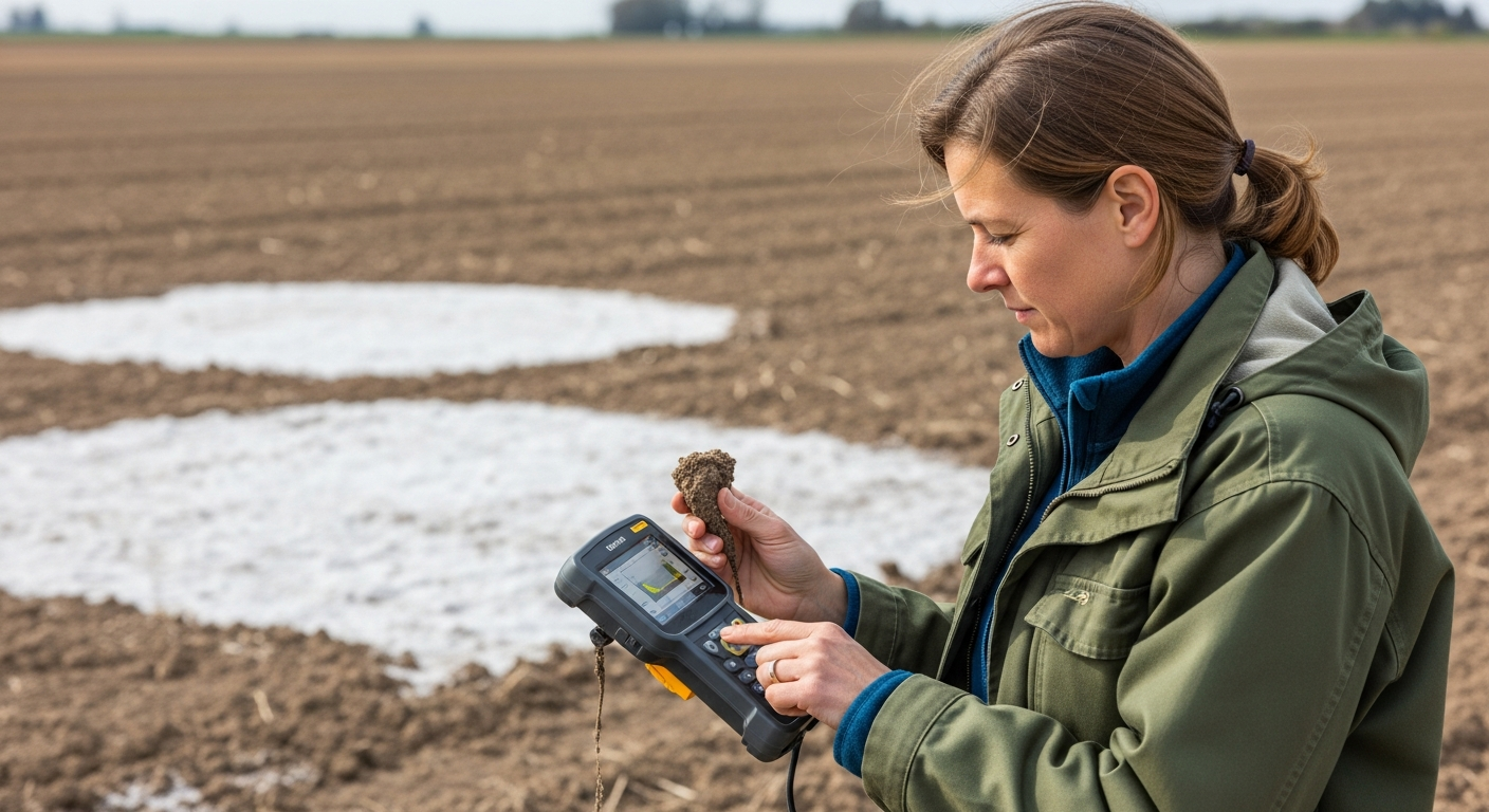
The accumulation of salts in the topsoil can create a hostile environment for most plant species. This leads to reduced crop productivity and can eventually render the land unsuitable for agriculture.
Understanding the mechanisms by which salinity affects plants is crucial for developing effective management strategies. Salt stress can disrupt the osmotic balance within plant cells.
This disruption leads to water loss and reduced turgor pressure, affecting various physiological processes. Furthermore, excessive sodium ions can interfere with the uptake of essential nutrients like potassium and calcium.
The long-term effects of soil salinity can be devastating to agricultural communities. Reduced crop yields can lead to food insecurity and economic hardship for farmers.
In addition to economic losses, soil salinity can also have environmental consequences. The degradation of soil health can lead to increased soil erosion and reduced water infiltration.
Therefore, it is essential to implement sustainable land management practices to prevent and mitigate soil salinity. This includes improving irrigation efficiency, promoting soil drainage, and using salt-tolerant crops.
How Soil Spectroscopy Can Detect Soil Salinity
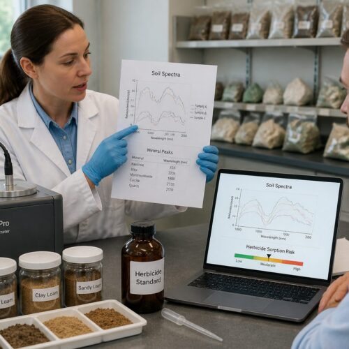
Soil spectroscopy is a technique that measures the spectral reflectance of soil samples across various wavelengths. Different soil components, including salts, exhibit unique spectral signatures.
When electromagnetic radiation interacts with soil, certain wavelengths are absorbed, while others are reflected. The pattern of reflectance varies depending on the chemical composition and physical properties of the soil.
By analyzing the spectral reflectance data, we can infer the presence and concentration of salts in the soil. This is because salts alter the way soil reflects light.
Specifically, the presence of salts can affect the absorption features in the visible, near-infrared (NIR), and shortwave-infrared (SWIR) regions of the electromagnetic spectrum. These spectral changes provide valuable information for soil spectroscopy salinity detection.
Soil spectroscopy offers several advantages over traditional methods of salinity assessment. It is a non-destructive technique, meaning that the soil sample remains intact after analysis.
This allows for further analysis of the same sample using other methods if needed. Soil spectroscopy is also a rapid and cost-effective technique, allowing for the analysis of a large number of samples in a short period of time.
This is particularly useful for large-scale salinity mapping projects. The spectral data obtained from soil spectroscopy can be used to create predictive models for soil salinity.
These models can be used to estimate salinity levels in areas where soil samples have not been collected. This allows for the creation of detailed salinity maps that can be used to guide salinity management decisions.
The accuracy of soil spectroscopy for salinity detection depends on several factors, including the quality of the spectral data and the calibration of the predictive models. It is important to use appropriate spectral pretreatments to remove noise and artifacts from the data.
Calibration models should be developed using a representative set of soil samples with known salinity levels. The models should also be validated using an independent set of soil samples to ensure their accuracy.
Soil spectroscopy can be used to detect different types of salts in the soil, including sodium chloride, magnesium sulfate, and calcium chloride. Each type of salt has a unique spectral signature.
This allows for the identification and quantification of different salts in the soil. This information can be used to develop targeted salinity management strategies.
Factors Affecting Spectral Reflectance in Saline Soils
Several factors influence the spectral reflectance of saline soils, making it essential to consider these when interpreting spectroscopy data. Soil moisture content, for instance, can significantly alter spectral signatures.
Water absorbs strongly in the NIR and SWIR regions, potentially masking the spectral features of salts. Soil texture and organic matter content also play a role in influencing spectral reflectance.
| Factor | Influence on Spectral Reflectance | Considerations for Analysis |
|---|---|---|
| Soil Moisture | Decreases reflectance in NIR and SWIR regions | Dry samples or use spectral pretreatments |
| Soil Texture | Affects scattering and absorption of light | Account for texture variations in models |
| Organic Matter | Darkens soil and influences spectral features | Remove organic matter or use spectral indices |
| Iron Oxides | Affect reflectance in the visible region | Use iron oxide indices to correct for interference |
Soil mineralogy can also affect spectral reflectance. Different minerals have unique spectral properties.
The presence of specific minerals can influence the overall spectral signature of the soil. Surface roughness is another factor that can affect spectral reflectance.
Rough surfaces tend to scatter light more than smooth surfaces. This can lead to variations in spectral reflectance.
The angle of incidence of the light source and the viewing angle of the spectrometer can also influence spectral reflectance. It is important to use consistent measurement protocols to minimize the effects of these factors.
The presence of vegetation cover can also affect spectral reflectance. Vegetation absorbs light in the visible region.
This can mask the spectral features of the soil. It is important to remove vegetation cover before collecting spectral data.
The type of salt present in the soil can also affect spectral reflectance. Different salts have different spectral properties.
This can lead to variations in spectral reflectance. It is important to consider the type of salt present in the soil when interpreting spectral data.
The concentration of salt in the soil also affects spectral reflectance. Higher concentrations of salt tend to decrease reflectance.
This is because salts absorb light. It is important to consider the concentration of salt in the soil when interpreting spectral data.
Using Spectral Data to Map Salinity Levels
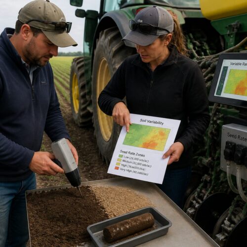
Spectral data acquired from soil samples can be used to create salinity maps, providing a spatial representation of salinity distribution across a field. This involves correlating spectral reflectance values with measured salinity levels using statistical models.
Techniques such as partial least squares regression (PLSR) and support vector machines (SVM) are commonly employed for this purpose. These models establish a relationship between spectral data and salinity measurements.
Once the model is calibrated, it can be applied to predict salinity levels for unsampled locations based on their spectral reflectance. This allows for the generation of detailed salinity maps.
These maps are valuable tools for precision agriculture, enabling targeted management of saline soils. They allow farmers to identify areas with high salinity.
The process of creating salinity maps using spectral data involves several steps. First, a representative set of soil samples is collected from the field.
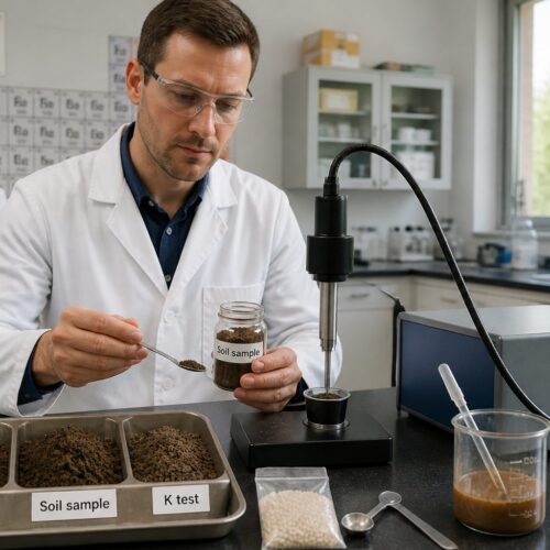
The samples are analyzed for salinity using standard laboratory methods. Spectral data is then acquired for each sample using a spectrometer.
The spectral data and salinity measurements are then used to calibrate a statistical model. The model is used to predict salinity levels for unsampled locations based on their spectral reflectance.
The predicted salinity levels are then used to create a salinity map. The accuracy of the salinity map depends on the quality of the spectral data, the accuracy of the salinity measurements, and the calibration of the statistical model.
It is important to validate the salinity map using an independent set of soil samples. This ensures that the map accurately represents the spatial distribution of salinity in the field.
Salinity maps can be used to guide various salinity management practices. For example, they can be used to target the application of soil amendments to areas with high salinity.
They can also be used to select appropriate salt-tolerant crops for different areas of the field. Salinity maps can also be used to monitor the effectiveness of salinity management practices over time.
By comparing salinity maps from different years, farmers can assess whether salinity levels are decreasing or increasing in response to management interventions. This allows for adaptive management strategies.
Practical Steps for Collecting and Analyzing Soil Spectral Data
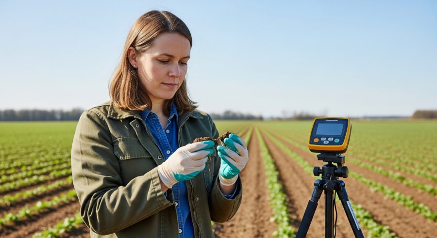
Collecting high-quality soil spectral data is crucial for accurate salinity detection. This involves selecting representative sampling locations across the field.
Samples should be collected from different depths to account for vertical salinity variations. It’s important to use consistent sampling procedures.
Once collected, the soil samples need to be prepared for spectral analysis. This typically involves air-drying the samples.
Spectral measurements can be acquired using a handheld spectrometer or a laboratory-based instrument. Proper calibration and standardization of the spectrometer are essential to ensure accurate and reliable data.
When selecting sampling locations, it is important to consider the spatial variability of soil salinity in the field. This can be done by using a grid-based sampling approach.
It is also important to collect samples from areas that are known to be saline. This will help to ensure that the spectral data is representative of the range of salinity levels in the field.
When collecting soil samples, it is important to avoid contamination. Samples should be collected using clean tools.
The samples should be stored in clean containers. The samples should be labeled clearly with the sampling location and date.
When preparing soil samples for spectral analysis, it is important to remove any large debris. This includes rocks, roots, and plant material.
The samples should be ground to a uniform particle size. This will help to ensure that the spectral data is consistent.
When acquiring spectral measurements, it is important to use a consistent measurement protocol. This includes using the same light source, the same viewing angle, and the same integration time.
The spectrometer should be calibrated regularly using a standard reference material. This will help to ensure that the spectral data is accurate and reliable.
Strategies for Managing Saline Soils
Managing saline soils requires a multifaceted approach that addresses the underlying causes of salinity and mitigates its effects. One strategy involves improving soil drainage to remove excess salts from the root zone.
This can be achieved through subsurface drainage systems or deep plowing to break up compacted soil layers. Another approach is to use salt-tolerant crops that can withstand high salinity levels.
- Implementing proper irrigation techniques
- Applying soil amendments like gypsum or organic matter
- Adopting conservation tillage practices
- Using cover crops to improve soil health
- Monitoring soil salinity levels regularly
Proper irrigation techniques are essential for managing saline soils. Over-irrigation can lead to the accumulation of salts in the topsoil.
Under-irrigation can lead to water stress and reduced crop yields. It is important to use irrigation methods that deliver water efficiently.
Soil amendments, such as gypsum, can help to improve soil structure and reduce salinity levels. Gypsum is a calcium sulfate mineral.
It can help to displace sodium ions from the soil. Organic matter can also help to improve soil structure and reduce salinity levels.
Conservation tillage practices can help to reduce soil erosion and improve water infiltration. This can help to prevent the accumulation of salts in the topsoil.
Cover crops can help to improve soil health and reduce salinity levels. Cover crops can help to prevent soil erosion.
They also add organic matter to the soil. Monitoring soil salinity levels regularly is essential for managing saline soils.
This allows farmers to track the effectiveness of salinity management practices. It also allows them to identify areas where salinity is increasing.
Integrating Spectroscopy Data with Salinity Management Plans
Soil spectroscopy data can be integrated into salinity management plans to optimize resource allocation and improve the effectiveness of remediation efforts. Salinity maps generated from spectral data can guide the placement of drainage systems.
They also help in the selection of appropriate salt-tolerant crops for different areas of the field. Spectroscopy data can be used to monitor the effectiveness of salinity management practices over time.
By tracking changes in spectral reflectance, we can assess whether salinity levels are decreasing or increasing in response to management interventions. This allows for adaptive management strategies.
Integrating soil spectroscopy with other precision agriculture technologies, such as variable-rate irrigation, can further enhance salinity management. This ensures that water and other inputs are applied precisely where they are needed.
Integrating spectroscopy data into salinity management plans can lead to more efficient use of resources. This can reduce the cost of salinity management.
It also improves the effectiveness of remediation efforts. By using salinity maps to guide the placement of drainage systems, farmers can ensure that drainage is installed where it is most needed.
This can reduce the amount of drainage that is required. By selecting appropriate salt-tolerant crops for different areas of the field, farmers can maximize crop yields.
This can increase the profitability of farming. By monitoring the effectiveness of salinity management practices over time, farmers can adjust their management strategies.
This ensures that they are using the most effective practices. Integrating soil spectroscopy with variable-rate irrigation allows farmers to apply water precisely where it is needed.
This can reduce water use and prevent the accumulation of salts in the topsoil. Integrating soil spectroscopy with other precision agriculture technologies can further enhance salinity management.
This can lead to more sustainable agricultural practices. It also improves the long-term health of the soil.
Case Studies: Successful Salinity Detection Applications
Several case studies have demonstrated the successful application of soil spectroscopy for salinity detection in various agricultural settings. In the San Joaquin Valley of California, researchers used soil spectroscopy to map salinity levels in almond orchards.
The resulting salinity maps were used to guide the installation of subsurface drainage systems. This improved drainage led to a significant reduction in soil salinity and increased almond yields.
In Australia, soil spectroscopy has been used to assess soil salinity in wheat-growing regions. The spectral data were used to identify areas where salinity was limiting wheat production.
Farmers were then able to implement targeted management practices, such as gypsum application, to improve soil health and wheat yields. These case studies highlight the practical benefits of soil spectroscopy for salinity detection and management.
In another case study in India, soil spectroscopy was used to assess soil salinity in rice-growing regions. The spectral data was used to identify areas where salinity was affecting rice production.
Farmers were then able to implement targeted management practices, such as the use of salt-tolerant rice varieties. This improved rice yields and increased farmer incomes.
In China, soil spectroscopy has been used to monitor soil salinity in coastal agricultural areas. The spectral data was used to track changes in salinity levels over time.
This allowed farmers to adapt their management practices to changing salinity conditions. These case studies demonstrate the versatility of soil spectroscopy for salinity detection.
It can be applied in various agricultural settings. It can also be used to support a range of salinity management practices.
The success of soil spectroscopy for salinity detection depends on several factors. These factors include the quality of the spectral data and the calibration of the predictive models.
It is important to use appropriate spectral pretreatments. This helps to remove noise and artifacts from the data.
Calibration models should be developed using a representative set of soil samples. They should have known salinity levels.
Challenges and Future Directions in Soil Spectroscopy Salinity Detection
Despite its advantages, soil spectroscopy for salinity detection faces certain challenges. One challenge is the influence of soil moisture, texture, and organic matter on spectral reflectance.
These factors can complicate the interpretation of spectral data and reduce the accuracy of salinity predictions. Another challenge is the need for robust calibration models that can account for regional variations in soil properties and salinity types.
Future research should focus on developing spectral pretreatments and calibration techniques. These should minimize the influence of confounding factors and improve the accuracy of salinity predictions.
There is also a need for developing cost-effective and portable spectrometers that can be used for on-site salinity assessment. This would enable farmers to rapidly assess salinity levels and implement timely management practices.
Another challenge is the lack of standardized protocols for collecting and analyzing soil spectral data. This can make it difficult to compare results from different studies.
Future research should focus on developing standardized protocols. This would improve the reliability and comparability of soil spectroscopy data.
There is also a need for developing more sophisticated data analysis techniques. This will improve the accuracy of salinity predictions.
Future research should focus on developing machine learning algorithms. These can be used to analyze soil spectral data.
There is also a need for developing more user-friendly software tools. This will make it easier for farmers to use soil spectroscopy for salinity management.
Future research should focus on developing web-based platforms. These can be used to process and visualize soil spectral data.
There is also a need for more education and training programs. These can help farmers to understand the benefits of soil spectroscopy.
They can also help them to use soil spectroscopy effectively. Future research should focus on developing outreach programs.
Conclusion
Soil spectroscopy offers a powerful and efficient tool for detecting soil spectroscopy salinity detection. By analyzing the spectral reflectance of soil, we can assess salinity levels and create detailed salinity maps.
These maps can be integrated into salinity management plans to optimize resource allocation and improve the effectiveness of remediation efforts. As technology advances, soil spectroscopy will play an increasingly important role in sustainable agriculture.
The ability to rapidly and cost-effectively assess soil salinity levels is crucial for managing this widespread environmental problem. Soil spectroscopy provides a valuable tool for achieving this goal.
By integrating soil spectroscopy into salinity management plans, farmers can improve the sustainability of their agricultural practices. This can lead to increased crop yields.
It also reduces the environmental impact of agriculture. As technology continues to advance, soil spectroscopy will become an even more powerful tool.
It will help to address the challenges of soil salinity around the world. The development of more cost-effective and portable spectrometers will make it easier for farmers to use soil spectroscopy.
The development of more sophisticated data analysis techniques will improve the accuracy of salinity predictions. The development of more user-friendly software tools will make it easier for farmers to interpret and use soil spectroscopy data.
By embracing soil spectroscopy, we can move towards a more sustainable future for agriculture. This helps to ensure food security for future generations.