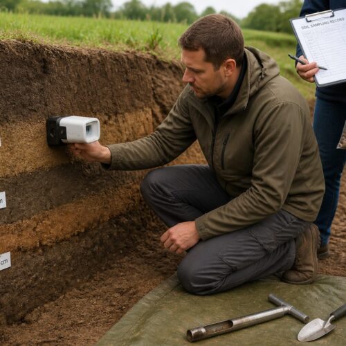

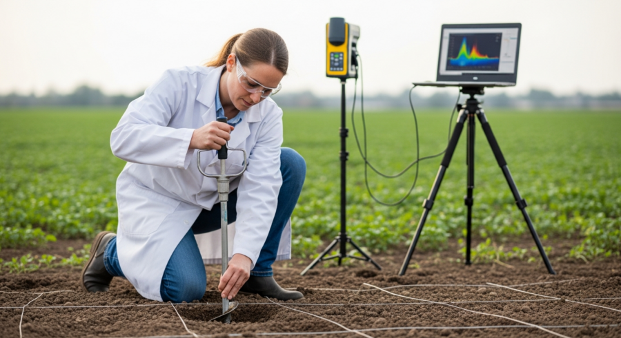
Precision agriculture relies on detailed soil information to optimize crop yields and resource use. Grid sampling soil spectroscopy offers a systematic approach to collecting this data. It involves dividing a field into a grid and collecting soil samples at each grid point. These samples are then analyzed using spectroscopy to determine their chemical and physical properties.
This method provides a comprehensive understanding of soil variability across the field. Implementing grid sampling for comprehensive soil spectroscopy analysis can significantly improve the accuracy of nutrient management and other agricultural practices.
This article will discuss how to effectively implement grid sampling for soil spectroscopy. We’ll cover everything from determining the optimal grid size to georeferencing samples for spatial analysis. Understanding these techniques is essential for maximizing the benefits of precision agriculture.
Understanding Grid Sampling for Soil Analysis
Grid sampling is a structured method for collecting soil samples across a field. The field is divided into a grid of equally sized cells, and a sample is taken from the center of each cell. This ensures uniform coverage and allows for the creation of detailed soil maps.
These maps can then be used to identify areas with nutrient deficiencies or other soil problems. This systematic approach helps in understanding the spatial variability of soil properties. Understanding the basics of grid sampling is the first step toward effective soil management.
Traditional soil sampling methods often involve collecting samples randomly or based on visual observations. These approaches can miss important variations in soil properties, leading to inaccurate recommendations for fertilizer application. Grid sampling soil spectroscopy, on the other hand, provides a more objective and comprehensive assessment.
The data collected through grid sampling can be used to create detailed maps of soil pH, organic matter content, and nutrient levels. These maps enable farmers to apply fertilizer and other inputs with greater precision. This targeted approach can reduce input costs, minimize environmental impact, and improve crop yields.
Furthermore, grid sampling provides a framework for tracking changes in soil properties over time. By repeating the sampling process in subsequent years, farmers can monitor the effectiveness of their management practices. This allows for continuous improvement and adaptation to changing conditions.
The spatial resolution of grid sampling allows for identifying localized problems that might be overlooked with other methods. For example, areas affected by soil compaction or pest infestations can be pinpointed and addressed specifically. This precision targeting can lead to more efficient use of resources and reduced environmental impact.
Grid sampling also facilitates the integration of other data sources, such as yield maps and remote sensing imagery. By combining these data layers, farmers can gain a more holistic understanding of their fields. This integrated approach can lead to more informed decision-making and improved overall farm management.
Another key benefit of grid sampling is its ability to support variable rate application of fertilizers and other inputs. This technology allows farmers to apply different rates of inputs to different areas of the field, based on the specific needs of each area. Variable rate application can significantly improve nutrient use efficiency and reduce the risk of over-application.
Determining Optimal Grid Size and Sampling Density
One of the most important decisions in grid sampling is determining the appropriate grid size. The grid size affects the sampling density, which is the number of samples collected per unit area. A smaller grid size results in a higher sampling density and a more detailed soil map.
However, a smaller grid size also means more samples to collect and analyze, increasing the cost and time required. The optimal grid size depends on the variability of the soil and the level of precision required. Finding this balance is key to effective grid sampling.
| Grid Size (ft) | Sampling Density (samples/acre) | Cost per Acre |
|---|---|---|
| 220 x 220 | 0.2 | Low |
| 110 x 110 | 0.8 | Medium |
| 55 x 55 | 3.2 | High |
| 27.5 x 27.5 | 12.8 | Very High |
Fields with high soil variability require a smaller grid size to accurately capture the spatial patterns. Fields with relatively uniform soils can use a larger grid size without sacrificing too much accuracy. It is important to consider the specific characteristics of each field when determining the optimal grid size.
Consider factors such as topography, soil type, and historical management practices when determining grid size. Areas with steep slopes or diverse soil types are likely to exhibit greater variability. Fields that have been intensively managed or have a history of uneven fertilizer application may also require a smaller grid size.
Another factor to consider is the cost-benefit ratio. While a smaller grid size provides more detailed information, the increased cost of sampling and analysis may not be justified in all cases. A cost-benefit analysis can help to determine the optimal grid size for a particular field.
It is also important to consider the limitations of the analytical methods being used. If the analytical methods are not sensitive enough to detect small differences in soil properties, then a smaller grid size may not provide any additional benefit. Choose a grid size that is appropriate for the analytical methods being used.
Ultimately, the optimal grid size will depend on the specific goals of the soil sampling program. If the goal is to identify areas with nutrient deficiencies for variable rate application, then a smaller grid size may be necessary. If the goal is simply to monitor soil health over time, then a larger grid size may be sufficient.
Setting Up a Grid Sampling Plan
Before beginning grid sampling, it’s essential to develop a detailed sampling plan. The plan should include a map of the field, the chosen grid size, and the location of each sampling point. This will ensure that samples are collected systematically and that the data can be accurately georeferenced.
The first step in creating a grid sampling plan is to obtain an accurate map of the field. This map can be created using GPS technology or aerial imagery. The map should show the boundaries of the field and any major features, such as roads, buildings, or water bodies.
Once you have a map, you can overlay a grid onto it. The grid should be aligned with the cardinal directions (north, south, east, west) to make it easier to navigate the field. The grid size should be chosen based on the soil variability and the desired level of precision.
After overlaying the grid, mark the location of each sampling point on the map. The sampling points should be located at the center of each grid cell. It is important to ensure that the sampling points are evenly spaced and that they cover the entire field.
Your sampling plan should also include a detailed description of the sampling procedures. This should specify the depth at which samples should be collected, the type of sampling equipment to be used, and the procedures for labeling and storing the samples. Consistent procedures are essential for ensuring the accuracy and reliability of the data.
Consider creating a checklist to ensure that all steps in the sampling plan are followed correctly. This checklist can be used by the sampling team to verify that each sampling point is located correctly, that samples are collected at the correct depth, and that samples are properly labeled and stored. A checklist can help to minimize errors and ensure that the data is of high quality.
It’s also important to document any deviations from the sampling plan. If it is not possible to collect a sample at a particular location due to obstacles or other reasons, this should be noted in the sampling plan. Any deviations from the plan should be documented and justified to ensure that the data is interpreted correctly.
Finally, review your sampling plan with the laboratory that will be analyzing the samples. The laboratory may have specific requirements for sample collection, handling, and storage. By consulting with the laboratory in advance, you can ensure that your sampling plan meets their requirements and that the data is of high quality.
Collecting Soil Samples Using Grid Sampling
Collecting soil samples using grid sampling requires careful attention to detail. It’s important to collect samples from the correct location and depth. This will ensure that the samples are representative of the soil in each grid cell.
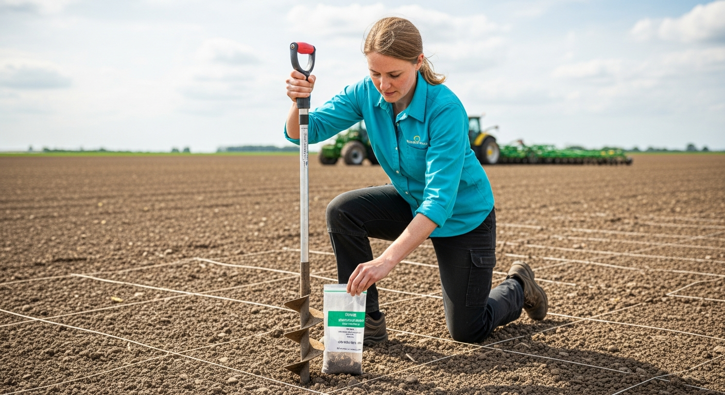
Use a GPS device to navigate to each sampling point. At each point, use a soil probe or auger to collect a sample from the desired depth. The depth of the sample will depend on the crop being grown and the soil properties being analyzed.
For most crops, a sample depth of 6-8 inches is sufficient. Be sure to remove any surface debris, such as plant material or rocks, before collecting the sample. This will prevent contamination of the sample and ensure accurate results.
Place each sample in a clean, labeled bag. The label should include the field name, grid cell number, and date of collection. This will help to keep track of the samples and ensure that they can be properly analyzed.
When using a soil probe or auger, make sure to clean the equipment between each sample. This prevents cross-contamination between sampling points and ensures the integrity of the results. A simple brush and clean water can be used for cleaning.
If the soil is very wet or compacted, it may be difficult to collect a representative sample. In these cases, it may be necessary to use a different sampling technique, such as a shovel or spade. Take extra care to ensure the sample is representative of the soil profile.
Consider taking multiple cores within a small radius of the designated sampling point and combining them into a single composite sample. This can help to reduce the variability within each grid cell and provide a more representative sample. Ensure the cores are thoroughly mixed before placing them in the labeled bag.
Document any unusual conditions encountered during sampling, such as areas with standing water, heavy compaction, or visible signs of pest or disease infestation. This information can be valuable for interpreting the soil analysis results and developing appropriate management strategies. A detailed record of field conditions enhances the value of the grid sampling effort.
Georeferencing Grid Samples for Spatial Analysis
Georeferencing is the process of assigning geographic coordinates to each soil sample. This allows the data to be analyzed spatially and used to create maps of soil properties. Accurate georeferencing is essential for precision agriculture.
Use a GPS device to record the latitude and longitude of each sampling point. This information can be recorded directly into a data logger or written down manually. Be sure to record the coordinates in a consistent format, such as decimal degrees.
- Use a high-accuracy GPS device
- Calibrate the GPS device regularly
- Record coordinates in decimal degrees
- Double-check coordinates for accuracy
- Store coordinates in a secure database
The georeferenced data can then be imported into a geographic information system (GIS) software. The GIS software can be used to create maps of soil properties and to perform spatial analysis. These maps can be used to guide fertilizer application and other management decisions.
When using a GPS device, ensure that it has a clear view of the sky to obtain accurate readings. Obstructions such as trees or buildings can interfere with the GPS signal and reduce the accuracy of the coordinates. In areas with poor GPS reception, consider using a differential GPS (DGPS) system.
Always double-check the coordinates to ensure that they are accurate. Even small errors in the coordinates can lead to significant errors in the spatial analysis. Use a map or aerial image to verify that the coordinates are located in the correct area of the field.
When storing the georeferenced data, use a consistent format and naming convention. This will make it easier to manage the data and to import it into GIS software. Consider using a database to store the data, as this will allow for easy querying and analysis.
Regularly back up the georeferenced data to prevent data loss. Store the backups in a secure location, such as a cloud storage service or an external hard drive. Data loss can be a major setback, so it is important to take precautions to protect your data.
Advantages and Disadvantages of Grid Sampling
Grid sampling offers several advantages over traditional soil sampling methods. It provides a more comprehensive and objective assessment of soil variability. It also allows for the creation of detailed soil maps that can be used to guide management decisions.
However, grid sampling also has some disadvantages. It can be more expensive and time-consuming than traditional methods. It also requires specialized equipment and software.
One of the main advantages of grid sampling is that it can identify areas with nutrient deficiencies that might be missed by traditional methods. This can lead to more efficient fertilizer application and higher crop yields. Grid sampling also allows for the identification of other soil problems, such as compaction or salinity.
One of the main disadvantages of grid sampling is the cost. The cost of collecting and analyzing the samples can be significant, especially for large fields. Grid sampling also requires specialized equipment, such as a GPS device and a soil probe or auger. Despite the costs, many farmers find that the benefits of grid sampling outweigh the disadvantages.
Another advantage of grid sampling is its ability to track changes in soil properties over time. By repeating the sampling process in subsequent years, farmers can monitor the effectiveness of their management practices and adjust their strategies accordingly. This can lead to continuous improvement in soil health and crop yields.
A disadvantage to consider is the potential for over-sampling in areas with low variability. In fields with relatively uniform soils, a dense grid may not provide much additional information compared to a less intensive sampling approach. Careful consideration of soil variability is crucial in optimizing the sampling strategy.
Grid sampling can also be challenging to implement in fields with complex topography or other obstacles. Steep slopes, dense vegetation, or bodies of water can make it difficult to access sampling points and collect representative samples. Adaptations to the sampling plan may be necessary in these situations.
The success of grid sampling depends on the accuracy and reliability of the soil analysis. It is important to choose a reputable laboratory with experience in analyzing soil samples for precision agriculture. Regular quality control checks are essential to ensure the accuracy of the results.
Soil Spectroscopy for Precision Nutrient Management
Soil spectroscopy is a rapid and cost-effective method for analyzing soil properties. It involves measuring the reflectance of light from a soil sample. The reflectance pattern can be used to estimate the concentration of various elements and compounds in the soil.
Soil spectroscopy can be used to measure a wide range of soil properties, including pH, organic matter content, nitrogen, phosphorus, and potassium. It can also be used to measure physical properties, such as soil texture and moisture content. This makes it a valuable tool for precision agriculture.
One of the main advantages of soil spectroscopy is its speed. A soil sample can be analyzed in a matter of minutes, compared to hours or days for traditional laboratory methods. This allows for a more rapid assessment of soil properties and faster decision-making.
Soil spectroscopy is also relatively inexpensive. The cost of analyzing a soil sample is typically much lower than the cost of traditional laboratory methods. This makes it a more accessible option for farmers and consultants.
However, soil spectroscopy requires careful calibration and validation. The accuracy of the results depends on the quality of the calibration models. It is important to use calibration models that are specific to the soil types and conditions in the area being studied.
Soil spectroscopy can be affected by factors such as soil moisture content, surface roughness, and the presence of organic matter. These factors can influence the reflectance pattern and affect the accuracy of the results. It is important to control for these factors when collecting and analyzing soil samples.
Near-infrared (NIR) spectroscopy is a commonly used technique for soil analysis. NIR spectroscopy measures the reflectance of light in the near-infrared region of the electromagnetic spectrum. This region is sensitive to the presence of organic matter, moisture, and various minerals.
Mid-infrared (MIR) spectroscopy is another technique that can be used for soil analysis. MIR spectroscopy measures the reflectance of light in the mid-infrared region of the electromagnetic spectrum. This region is sensitive to the presence of various functional groups in organic molecules.
Integrating Soil Spectroscopy with Grid Sampling
Integrating soil spectroscopy with grid sampling can provide a powerful tool for precision agriculture. By combining the comprehensive coverage of grid sampling with the rapid analysis of soil spectroscopy, farmers can obtain a detailed understanding of soil variability and optimize nutrient management.
Collect soil samples using grid sampling, as described above. Then, analyze the samples using soil spectroscopy. The data can be used to create detailed maps of soil properties, which can then be used to guide fertilizer application and other management decisions.
The combination of grid sampling soil spectroscopy allows for a more targeted approach to nutrient management. Farmers can apply fertilizer only where it is needed, reducing input costs and minimizing environmental impact. This approach can also lead to higher crop yields and improved profitability.
Using grid sampling for comprehensive soil spectroscopy analysis and precision nutrient management can be a game-changer for modern agriculture. The ability to understand and address soil variability at a granular level empowers farmers to make more informed decisions. This leads to more sustainable and productive farming practices.
When integrating soil spectroscopy with grid sampling, it is important to ensure that the soil samples are properly prepared for analysis. This may involve drying, grinding, and sieving the samples to ensure that they are homogeneous and representative.
The data from soil spectroscopy can be used to create variable rate application maps for fertilizers and other inputs. These maps can be loaded into a variable rate applicator, which will automatically adjust the application rate based on the soil properties at each location in the field.
Consider using a combination of soil spectroscopy and traditional laboratory analysis. Soil spectroscopy can be used to screen a large number of samples quickly and inexpensively, while traditional laboratory analysis can be used to confirm the results and to measure properties that cannot be accurately measured by soil spectroscopy.
Regularly calibrate and validate the soil spectroscopy models to ensure that they are accurate. This can be done by comparing the results from soil spectroscopy to the results from traditional laboratory analysis. Calibration and validation are essential for ensuring the reliability of the data.
Conclusion
Grid sampling soil spectroscopy offers a powerful approach to understanding and managing soil variability. By dividing a field into a grid and analyzing soil samples at each grid point, farmers can obtain a comprehensive assessment of soil properties. This information can be used to guide fertilizer application and other management decisions.
While grid sampling can be more expensive and time-consuming than traditional methods, the benefits often outweigh the costs. The ability to target fertilizer application and other inputs with greater precision can lead to higher crop yields, reduced input costs, and minimized environmental impact.
Adopting grid sampling for comprehensive soil spectroscopy analysis is a step towards more sustainable and efficient agriculture. It allows for a more nuanced and informed approach to soil management. This ultimately benefits both the farmer and the environment.
As technology continues to advance, soil spectroscopy and other precision agriculture tools will become even more accessible and affordable. Farmers who embrace these technologies will be well-positioned to thrive in the future.
The future of agriculture lies in data-driven decision-making. Grid sampling soil spectroscopy provides the data needed to make informed decisions about nutrient management and other agricultural practices. Embracing this technology is essential for ensuring the long-term sustainability and profitability of farming operations.
Consider the long-term benefits of investing in grid sampling soil spectroscopy. While the initial cost may seem high, the long-term savings in fertilizer costs and the increased crop yields can quickly offset the investment. This technology is an investment in the future of your farm.
Stay informed about the latest advancements in soil spectroscopy and other precision agriculture technologies. New sensors, software, and analytical methods are constantly being developed. By staying informed, you can ensure that you are using the best available tools for managing your soil and crops.
Ultimately, the goal of grid sampling soil spectroscopy is to improve the efficiency and sustainability of agriculture. By understanding and managing soil variability, farmers can reduce their environmental impact, increase their profitability, and ensure the long-term health of their land. This is a win-win situation for both the farmer and the environment.