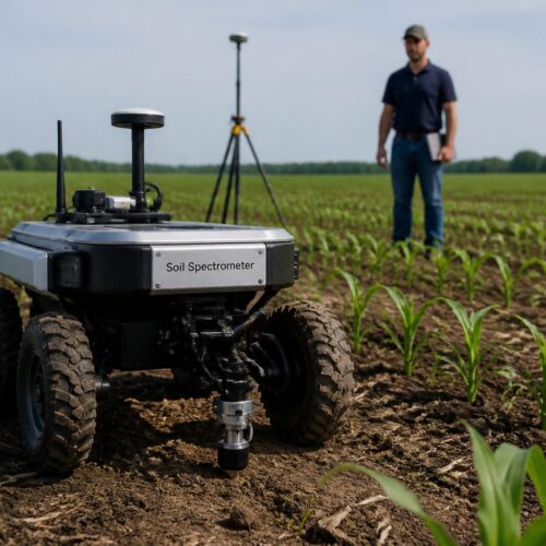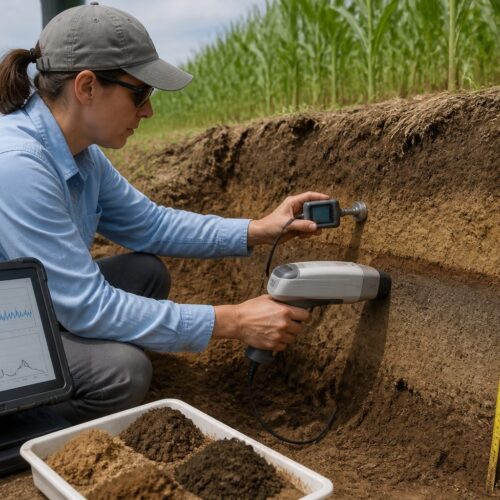
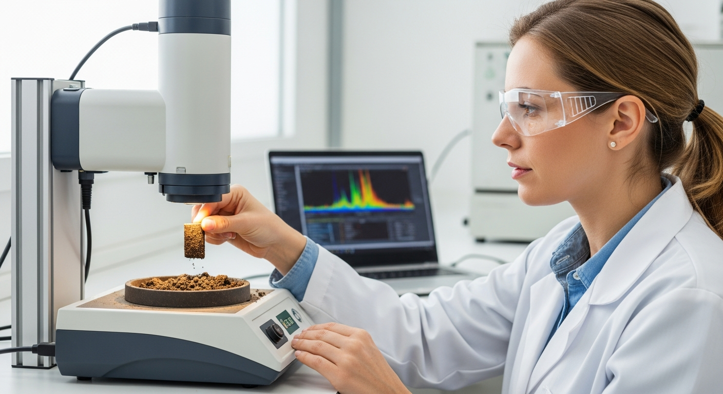
Precision agriculture relies on detailed information about soil properties to optimize resource use and maximize yields. Traditional soil analysis methods, while accurate, are time-consuming and expensive. Soil spectroscopy offers a rapid and cost-effective alternative for assessing soil composition and characteristics.
However, spectroscopy alone provides only point-based measurements. To create comprehensive soil maps, integrating soil spectroscopy with remote sensing technologies is essential. This integration leverages the strengths of both methods, providing spatially continuous and detailed soil information for precision agriculture applications.
By combining ground-based spectral data with airborne or satellite imagery, we can extrapolate soil properties across large areas. The integration of soil spectroscopy remote sensing integration is transforming how we understand and manage our agricultural lands, leading to more sustainable and efficient farming practices.
The Benefits of Combining Spectroscopy and Remote Sensing
Combining soil spectroscopy and remote sensing offers a multitude of benefits for precision agriculture. One of the primary advantages is the ability to create high-resolution soil maps that cover extensive areas.
These maps provide detailed information about soil properties such as organic matter content, nutrient levels, and texture. Farmers can use this information to make informed decisions about fertilizer application, irrigation, and other management practices.
Another key benefit is the reduction in time and labor compared to traditional soil sampling methods. Collecting and analyzing soil samples across a large field can be a laborious and time-intensive process.
By using soil spectroscopy remote sensing integration, farmers can quickly assess soil properties without the need for extensive physical sampling. This allows for more frequent monitoring of soil conditions and faster adjustments to management strategies.
Furthermore, the integration of these technologies enables a more holistic understanding of soil variability. Remote sensing data captures spatial patterns and variations in soil properties across the field.
Soil spectroscopy provides detailed information about the chemical and physical composition of the soil at specific locations. Combining these data sets allows for a more complete and accurate picture of soil conditions, leading to better management decisions.
The ability to create high-resolution soil maps allows for targeted interventions. Farmers can precisely apply fertilizers, pesticides, and irrigation water only where needed.
This reduces input costs, minimizes environmental impacts, and improves overall resource efficiency. The reduction in labor costs associated with traditional soil sampling also frees up valuable time for farmers to focus on other important aspects of their operations.
Improved understanding of soil variability leads to better crop performance. By accounting for the spatial variations in soil properties, farmers can select the most appropriate crop varieties for each area of the field.
They can also adjust planting densities and other management practices to optimize crop growth and yield. This results in more uniform crop stands and higher overall productivity.
The integration of soil spectroscopy and remote sensing also facilitates long-term monitoring of soil health. By periodically mapping soil properties, farmers can track changes in soil quality over time.
This allows them to identify areas where soil degradation is occurring and to implement corrective measures before significant damage occurs. Long-term monitoring also provides valuable data for assessing the effectiveness of different management practices and for adapting strategies to changing environmental conditions.
The combined data sets can also be used to model and predict future soil conditions. This predictive capability can help farmers to anticipate potential problems and to proactively implement management strategies to mitigate risks.
For example, if the model predicts that soil salinity will increase in a particular area of the field, farmers can take steps to improve drainage or to select salt-tolerant crop varieties.
Types of Remote Sensing Data Used in Soil Analysis
Several types of remote sensing data can be used in conjunction with soil spectroscopy for soil analysis. Satellite imagery is one of the most common and widely available sources of remote sensing data.
Satellites such as Landsat and Sentinel provide multispectral imagery that can be used to assess soil properties. These images capture data in different portions of the electromagnetic spectrum, which can be related to soil characteristics such as organic matter content and moisture levels.
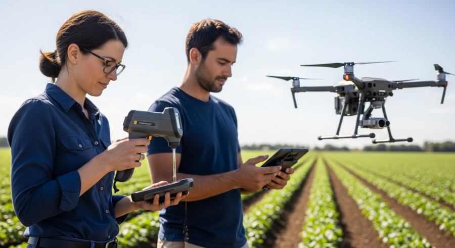
Aerial surveys, often conducted using drones or aircraft, offer another valuable source of remote sensing data. Aerial surveys can provide higher resolution imagery than satellite imagery, allowing for more detailed analysis of soil properties.
Drones can be equipped with various sensors, including multispectral, hyperspectral, and thermal cameras. Hyperspectral imagery captures data in many narrow bands of the electromagnetic spectrum, providing detailed spectral information that can be used to identify specific soil components.
Thermal imagery can be used to assess soil moisture content and temperature variations across the field. This information can be valuable for irrigation management and identifying areas of water stress.
LiDAR (Light Detection and Ranging) is another remote sensing technology that can be used to create high-resolution topographic maps of the soil surface. LiDAR data can be used to identify areas of erosion, drainage patterns, and other features that influence soil properties.
Multispectral imagery is relatively inexpensive and readily available. It is suitable for mapping broad soil properties over large areas.
Hyperspectral imagery, while more expensive, provides more detailed spectral information. This allows for the identification of specific soil components and the assessment of more complex soil properties.
Thermal imagery is particularly useful for assessing soil moisture stress. It can help farmers to identify areas where irrigation is needed and to optimize irrigation scheduling.
LiDAR data provides valuable information about soil topography and drainage. This information can be used to improve water management and to prevent soil erosion.
The choice of remote sensing data depends on the specific application and the level of detail required. For large-scale soil mapping, satellite imagery may be sufficient.
For more detailed analysis of soil properties, drone-based hyperspectral imagery may be more appropriate. The cost of data acquisition and analysis is also a factor to consider.
Radar data, including Synthetic Aperture Radar (SAR), can also be used. SAR is sensitive to soil moisture and surface roughness, providing complementary information to optical remote sensing.
Data fusion techniques can be used to combine different types of remote sensing data to improve the accuracy and completeness of soil maps.
Integrating Spectral Data with Satellite Imagery
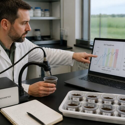
Integrating spectral data obtained from soil spectroscopy with satellite imagery is a crucial step in creating comprehensive soil maps. The process typically involves several steps, starting with the collection of soil samples and spectral measurements in the field.
These samples are analyzed in the laboratory to determine their chemical and physical properties. Simultaneously, spectral measurements are taken using portable spectrometers to establish a relationship between soil properties and spectral reflectance.
| Satellite | Sensor | Spatial Resolution | Spectral Bands |
|---|---|---|---|
| Landsat 8 | OLI | 30 meters | Multispectral |
| Sentinel-2 | MSI | 10-20 meters | Multispectral |
| WorldView-3 | Various | 0.3-1.2 meters | Multispectral, Hyperspectral |
| PlanetScope | Various | 3-5 meters | Multispectral |
The next step involves acquiring satellite imagery for the area of interest. The satellite data is pre-processed to correct for atmospheric effects and geometric distortions.
Then, a calibration model is developed using the spectral measurements and soil properties from the field samples. This model is used to predict soil properties across the entire area covered by the satellite imagery.
The accuracy of the calibration model is critical for the success of the integration. The model should be validated using an independent set of soil samples to ensure that it is accurate and reliable.
Several different types of calibration models can be used, including linear regression, multiple linear regression, and machine learning algorithms. The choice of model depends on the complexity of the relationship between soil properties and spectral reflectance.
The spatial resolution of the satellite imagery is also an important factor to consider. Higher resolution imagery allows for more detailed mapping of soil properties, but it is also more expensive.
The spectral resolution of the satellite imagery is also important. Imagery with more spectral bands provides more information about soil properties.
The timing of the satellite imagery acquisition is also important. The imagery should be acquired when the soil surface is relatively dry and free of vegetation cover.
The integration process may involve the use of Geographic Information Systems (GIS) software. GIS software provides tools for managing, analyzing, and visualizing spatial data.
The final product of the integration is a soil map that shows the spatial distribution of soil properties across the area of interest. This map can be used for a variety of applications in precision agriculture and land management.
Applications in Large-Scale Soil Mapping
The integration of soil spectroscopy and remote sensing has numerous applications in large-scale soil mapping. One of the most significant applications is in precision agriculture, where detailed soil maps are used to optimize fertilizer application.
By knowing the spatial distribution of nutrient levels in the soil, farmers can apply fertilizer only where it is needed, reducing waste and minimizing environmental impacts. This targeted approach can lead to significant cost savings and increased crop yields.
Another important application is in land management and conservation. Soil maps can be used to identify areas that are prone to erosion or degradation. This information can be used to implement conservation practices such as terracing, contour plowing, and cover cropping to protect the soil and prevent further degradation.
Soil maps are also valuable for assessing soil carbon stocks. Soil carbon is an important component of the global carbon cycle, and changes in soil carbon stocks can have a significant impact on climate change.
By mapping soil carbon stocks across large areas, we can better understand the role of soils in mitigating climate change. This information can be used to develop strategies for increasing soil carbon sequestration and reducing greenhouse gas emissions from agriculture.
Additionally, large-scale soil mapping can be used for environmental monitoring and assessment. Soil maps can be used to assess the impact of pollution on soil quality. This information can be used to develop remediation strategies and protect human health and the environment.
Large-scale soil mapping is also useful for regional planning. It allows for informed decisions about land use and development.
Soil maps can help to identify areas that are suitable for agriculture, forestry, or urban development. They can also help to identify areas that are at risk of environmental degradation.
The integration of soil spectroscopy and remote sensing can also be used to monitor the effectiveness of land management practices. By comparing soil maps from different years, it is possible to assess whether management practices are improving soil quality.
This information can be used to adjust management practices and to ensure that they are sustainable. Soil maps are also valuable for assessing the impact of climate change on soil resources.
By monitoring changes in soil properties over time, it is possible to assess the vulnerability of soils to climate change. This information can be used to develop adaptation strategies to protect soil resources.
Soil mapping can also contribute to carbon credit programs. Accurate assessment of soil carbon sequestration is essential for these programs.
This information can be used to generate carbon credits that can be sold on the carbon market. In this way, soil mapping can provide economic incentives for sustainable land management.
Challenges in Data Integration
Despite the numerous benefits of integrating soil spectroscopy and remote sensing, there are also several challenges that must be addressed. One of the primary challenges is the difference in scale between ground-based spectral measurements and remote sensing data.
Soil spectroscopy provides detailed information about soil properties at specific locations. Remote sensing data, on the other hand, provides spatially continuous information at a coarser resolution.
- Scale differences between data sources
- Atmospheric correction of remote sensing data
- Calibration model development
- Data processing and analysis
- Cost of data acquisition and analysis
Another challenge is the need for accurate atmospheric correction of remote sensing data. Atmospheric effects can significantly influence the spectral reflectance of the soil surface, leading to errors in soil property estimates.
Developing robust calibration models that can accurately predict soil properties from spectral data is also a challenge. The relationship between soil properties and spectral reflectance can be complex and influenced by various factors, such as soil moisture, surface roughness, and vegetation cover.
The difference in spatial resolution requires careful consideration. Techniques like spatial averaging or downscaling may be necessary.
Atmospheric correction is crucial for accurate remote sensing data. Various atmospheric correction algorithms are available, but selecting the appropriate one is important.
Calibration model development requires a representative set of soil samples. The samples should be collected across the range of soil conditions in the area of interest.
Data processing and analysis can be computationally intensive. High-performance computing resources may be required.
The cost of data acquisition and analysis can be a barrier to adoption. However, the benefits of integrated soil analysis can outweigh the costs in many cases.
Vegetation cover can also pose a challenge. The presence of vegetation can obscure the soil surface and affect spectral reflectance.
Soil moisture content can also influence spectral reflectance. It is important to account for soil moisture variations when developing calibration models.
Future Trends in Integrated Soil Analysis
The field of integrated soil analysis is rapidly evolving, with several exciting trends emerging. One of the most promising trends is the increasing use of machine learning algorithms for data integration and analysis.
Machine learning algorithms can be used to develop more accurate and robust calibration models that can account for the complex relationships between soil properties and spectral reflectance. These algorithms can also be used to integrate data from multiple sources, such as satellite imagery, aerial surveys, and ground-based measurements, to create more comprehensive soil maps.
Another trend is the development of new sensors and platforms for remote sensing. Drones are becoming increasingly popular for aerial surveys, offering a cost-effective and flexible platform for collecting high-resolution imagery.
New sensors, such as hyperspectral and thermal cameras, are also being developed to provide more detailed information about soil properties. These advancements will enable more accurate and comprehensive soil analysis.
The use of cloud computing and big data analytics is also becoming more prevalent in soil analysis. Cloud computing platforms provide the computational resources needed to process and analyze large volumes of remote sensing data.
Big data analytics techniques can be used to extract meaningful insights from these data sets. This will enable more efficient and effective soil analysis and management.
The development of more sophisticated spectral libraries is also a key trend. These libraries will provide a more comprehensive reference for identifying soil components from spectral data.
The integration of sensor networks and the Internet of Things (IoT) is also emerging. This will allow for real-time monitoring of soil conditions and the automated control of irrigation and fertilizer application.
The use of citizen science is also gaining traction. Citizen scientists can collect soil samples and spectral measurements, contributing to large-scale soil mapping efforts.
The development of standardized protocols for data collection and analysis is also important. This will ensure that data from different sources can be easily integrated and compared.
The increasing availability of open-source software and data is also facilitating the adoption of integrated soil analysis. This reduces the cost of data acquisition and analysis and makes the technology more accessible to a wider range of users.
The focus on sustainable agriculture is driving the demand for integrated soil analysis. Farmers are increasingly looking for ways to improve resource efficiency and reduce environmental impacts.
The Role of Spatial Analysis
Spatial analysis plays a crucial role in integrating soil spectroscopy and remote sensing data. It provides the tools and techniques necessary to understand the spatial distribution of soil properties and their relationships with other environmental factors.
Geostatistical methods, such as kriging and cokriging, are commonly used to interpolate soil properties from point-based measurements to create continuous soil maps. These methods take into account the spatial autocorrelation of soil properties, meaning that values at nearby locations are more similar than values at distant locations.
Spatial analysis can also be used to identify areas of soil variability and to delineate management zones within a field. Management zones are areas with similar soil properties and yield potential, which can be managed as a single unit.
By delineating management zones, farmers can tailor their management practices to the specific needs of each zone, optimizing resource use and maximizing yields. This approach is a key component of precision agriculture.
Furthermore, spatial analysis can be used to assess the impact of management practices on soil properties and crop yields. By comparing soil maps and yield data from different years, farmers can evaluate the effectiveness of their management strategies and make adjustments as needed.
This iterative process of monitoring, evaluation, and adjustment is essential for continuous improvement in precision agriculture.
Spatial regression techniques can be used to model the relationship between soil properties and other environmental factors. This can help to identify the factors that are most important in determining soil variability.
Spatial clustering techniques can be used to identify areas with similar soil properties. This can be useful for delineating management zones or for identifying areas that are at risk of environmental degradation.
Spatial overlay analysis can be used to combine soil maps with other spatial data layers, such as topographic maps, land use maps, and climate data. This can provide a more comprehensive understanding of soil resources and their relationships with other environmental factors.
Geographic Information Systems (GIS) software provides a powerful platform for spatial analysis. GIS software allows users to manage, analyze, and visualize spatial data.
Remote sensing data can be integrated into GIS software. This allows for the creation of soil maps and the analysis of soil properties.
Spatial statistics are essential for understanding patterns in soil data. These statistics help quantify the spatial relationships.
Proper spatial analysis ensures informed decision-making in land management. It provides critical insights for sustainable practices.
Case Studies and Examples
Several case studies demonstrate the successful integration of soil spectroscopy and remote sensing in precision agriculture. One example is the use of satellite imagery and soil spectroscopy to map soil organic matter content in agricultural fields in the Midwestern United States.
Researchers collected soil samples and spectral measurements in the field and used these data to calibrate satellite imagery. The resulting soil maps were used to guide variable-rate fertilizer application, leading to increased crop yields and reduced fertilizer use.
Another case study involves the use of drone-based hyperspectral imagery to assess soil salinity in irrigated agricultural lands in California. High soil salinity can reduce crop yields and limit agricultural productivity.
Researchers used hyperspectral imagery to identify areas of high soil salinity and developed management strategies to reduce salt accumulation in the soil. These strategies included improved irrigation practices and the use of salt-tolerant crop varieties.
A third example is the use of LiDAR data and soil spectroscopy to map soil erosion in hilly agricultural landscapes in Europe. Soil erosion can lead to the loss of valuable topsoil and reduced agricultural productivity.
Researchers used LiDAR data to create high-resolution topographic maps of the soil surface and combined these maps with soil spectroscopy data to identify areas of high erosion risk. This information was used to implement conservation practices such as terracing and contour plowing to reduce soil erosion.
In Australia, the technology is used to map soil texture across vast wheat-growing regions. This helps farmers optimize planting and harvesting schedules.
In Brazil, integrated soil analysis is employed to monitor deforestation impacts on soil health. This aids in conservation efforts in the Amazon rainforest.
In Africa, these methods are assisting in identifying degraded lands suitable for restoration. This promotes sustainable land management practices.
A study in China used remote sensing to map heavy metal contamination in agricultural soils. This helped to identify areas where remediation was needed.
Another study in India used soil spectroscopy to assess soil fertility in rice paddies. This helped farmers optimize fertilizer application and increase yields.
These examples demonstrate the wide range of applications for integrated soil analysis. The technology can be used to address a variety of challenges in agriculture and land management.
Conclusion
The integration of soil spectroscopy and remote sensing is a powerful tool for precision agriculture and land management. By combining the strengths of both methods, we can create comprehensive soil maps that provide detailed information about soil properties across large areas.
These maps can be used to optimize fertilizer application, improve irrigation management, and implement conservation practices to protect the soil and enhance agricultural sustainability. As technology continues to advance, we can expect even more sophisticated and effective methods for integrating soil spectroscopy remote sensing integration in the future, leading to more sustainable and productive agricultural systems.
This integrated approach offers a pathway towards more resilient and efficient agriculture. It empowers farmers with the knowledge needed for informed decision-making.
The future of agriculture relies on sustainable practices. Integrated soil analysis plays a key role in achieving this goal.
Continued research and development are crucial for advancing this field. This will enable even more accurate and comprehensive soil analysis.
The benefits extend beyond agriculture to environmental monitoring and conservation. This technology is vital for protecting our planet’s soil resources.