Precision agriculture is rapidly evolving, and with it comes the need for more advanced techniques in soil analysis. Traditional methods often fall short in providing the detailed, spatially explicit data required for effective soil management. This is where soil salinity mapping technology steps in, offering a powerful means to understand and combat one of the most significant threats to agricultural productivity.
This article will discuss the importance of soil salinity mapping technology, focusing on electromagnetic induction and remote sensing, and how these tools can be used to develop effective salinity management strategies. Protecting our agricultural lands depends on adopting these innovative methods.
We will explore the problem of soil salinity, evaluate traditional assessment methods, and then move into how electromagnetic induction and remote sensing provide solutions. Real-world examples of successful remediation projects will demonstrate the practical impact of these technologies.
The Problem of Soil Salinity in Agriculture
Soil salinity is a major environmental and economic problem affecting agricultural regions worldwide. It reduces crop yields, degrades soil structure, and can eventually lead to land abandonment.
The accumulation of salts in the topsoil can occur naturally in arid and semi-arid climates, where evaporation rates are high. However, human activities, such as irrigation with saline water, deforestation, and poor drainage systems, often exacerbate the problem.
When salt concentrations become too high, plants struggle to absorb water and nutrients, leading to stunted growth and reduced productivity. This can have devastating consequences for farmers and food security.
Beyond the immediate impact on crop yields, soil salinity also has long-term effects on soil health. High salt concentrations can disperse soil aggregates, leading to decreased water infiltration and increased erosion.
Soil salinity poses a significant threat to global food production. As arable land becomes increasingly scarce, the need to manage and remediate saline soils becomes even more critical.
The economic consequences of soil salinity are substantial, impacting both individual farmers and national economies. Reduced crop yields translate to lower incomes for farmers and decreased export revenues for countries dependent on agriculture.
Furthermore, the degradation of soil structure due to salinity can lead to increased costs for soil remediation and management. Addressing soil salinity requires a multi-faceted approach, including prevention, monitoring, and remediation strategies.
Understanding the causes and consequences of soil salinity is the first step towards developing effective solutions. By implementing sustainable land management practices and adopting innovative technologies, we can mitigate the impact of soil salinity and ensure the long-term health of our agricultural lands.
The challenge is particularly acute in regions already facing water scarcity and climate change impacts. These factors can further exacerbate soil salinity problems, making it even more difficult to maintain agricultural productivity.
Traditional Methods for Assessing Soil Salinity
Traditional methods for assessing soil salinity typically involve collecting soil samples from the field and analyzing them in a laboratory. These methods, while accurate, are time-consuming, labor-intensive, and costly.
The process usually involves grid sampling, where soil samples are collected at regular intervals across the field. Each sample is then analyzed for electrical conductivity (EC), which is a measure of the salt content in the soil.
While lab analysis provides precise measurements, the spatial resolution is limited by the number of samples collected. This means that significant variations in soil salinity within the field may go undetected.
Furthermore, traditional methods only provide a snapshot of soil salinity at the time of sampling. Soil salinity can change rapidly due to weather events, irrigation practices, and other factors, making it difficult to monitor the problem effectively over time.
The accuracy of traditional methods is highly dependent on the quality of the sampling and laboratory analysis. Inconsistent sampling techniques or errors in the lab can lead to inaccurate results and flawed management decisions.
Moreover, the cost of collecting and analyzing soil samples can be prohibitive for many farmers, especially those with large landholdings. This limits the frequency and extent of soil salinity monitoring, making it difficult to detect and address problems in a timely manner.
Traditional methods also require significant expertise in soil science and laboratory techniques. This can be a barrier for farmers who lack the necessary training and resources. The reliance on laboratory analysis also introduces a delay in obtaining results, which can hinder timely decision-making.
Despite their limitations, traditional methods remain an important tool for validating and calibrating other soil salinity assessment techniques. They provide a baseline for comparison and help to ensure the accuracy of more advanced methods.
The labor intensity and time constraints of traditional methods underscore the need for more efficient and cost-effective solutions for soil salinity assessment. This is where technologies like electromagnetic induction and remote sensing offer significant advantages.
Electromagnetic Induction (EMI) for Salinity Mapping
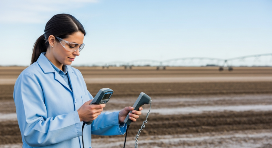
Electromagnetic induction (EMI) is a geophysical technique used to measure soil electrical conductivity without direct contact with the ground. EMI sensors emit an electromagnetic field and measure the response of the soil, which is related to its salinity.
EMI offers several advantages over traditional methods, including rapid data acquisition, non-destructive measurement, and the ability to map soil salinity at high spatial resolution. This allows for a more detailed and accurate assessment of salinity patterns across the field.
| EMI Method | Depth of Measurement | Advantages | Limitations |
|---|---|---|---|
| Vertical Dipole | Shallower | High sensitivity to surface salinity | Less sensitive to deeper salinity |
| Horizontal Dipole | Deeper | Sensitive to deeper salinity | Less sensitive to surface salinity |
| Dual Dipole | Multiple depths | Provides information on salinity distribution with depth | More complex data interpretation |
| On-the-go Systems | Variable | Rapid data acquisition | Requires accurate GPS for spatial referencing |
EMI data can be collected using handheld devices, tractor-mounted sensors, or even airborne systems. The choice of sensor depends on the scale of the mapping project and the desired level of detail.
The non-contact nature of EMI measurements minimizes soil disturbance and allows for repeated measurements over time. This is particularly useful for monitoring changes in soil salinity in response to management practices or environmental factors.
EMI sensors can be calibrated using soil samples to improve the accuracy of salinity estimates. This involves collecting soil samples at representative locations across the field and correlating the measured EC values with the EMI readings.
The interpretation of EMI data requires some expertise in geophysics and soil science. Factors such as soil moisture, temperature, and clay content can influence EMI readings and need to be taken into account.
Despite these challenges, EMI is a valuable tool for mapping soil salinity and guiding management decisions. Its ability to provide high-resolution spatial data makes it an essential component of precision agriculture.
The cost of EMI equipment can be a barrier for some farmers, but the long-term benefits of improved soil management often outweigh the initial investment. Furthermore, the availability of EMI services from agricultural consultants and research institutions makes the technology accessible to a wider range of users.
Integrating Remote Sensing Data for Large-Scale Mapping
Remote sensing techniques provide a means to assess soil salinity over large areas using satellite or aerial imagery. These techniques rely on the fact that soil salinity affects the spectral reflectance of the soil surface.
Different sensors, such as multispectral and hyperspectral imagers, can capture information about the soil’s reflectance at different wavelengths. This data can then be used to develop salinity indices and maps.
One of the key advantages of remote sensing is its ability to cover vast areas quickly and efficiently. This makes it particularly useful for regional-scale salinity assessments and monitoring changes over time.
However, remote sensing data can be affected by atmospheric conditions, vegetation cover, and soil moisture. Therefore, it is often necessary to combine remote sensing data with ground-based measurements, such as EMI data or soil samples, to improve the accuracy of salinity maps.
Combining remote sensing with electromagnetic induction provides superior soil salinity mapping technology. By integrating data from multiple sources, a more complete and reliable picture of soil salinity can be obtained.
The resolution of remote sensing imagery can vary depending on the sensor and platform used. Higher resolution imagery provides more detailed information about soil salinity patterns, but it also comes at a higher cost.
The development of salinity indices is a crucial step in using remote sensing data for soil salinity mapping. These indices are mathematical combinations of different spectral bands that are sensitive to soil salinity.
The accuracy of remote sensing-based salinity maps depends on the quality of the imagery and the calibration process. Ground-based measurements are essential for validating and calibrating remote sensing data.
Remote sensing data can be used to monitor the effectiveness of salinity management practices over time. By comparing salinity maps from different years, land managers can assess whether their efforts are having the desired impact.
The integration of remote sensing and EMI data provides a powerful tool for understanding and managing soil salinity at multiple scales. This integrated approach is essential for achieving sustainable agricultural practices and protecting valuable land resources.
Developing Salinity Management Strategies
Once soil salinity maps have been created, the information can be used to develop targeted salinity management strategies. These strategies aim to reduce salt accumulation, improve soil health, and enhance crop productivity.
Effective salinity management often involves a combination of approaches, including improving drainage, using salt-tolerant crops, and implementing appropriate irrigation practices. The specific strategies will depend on the local conditions and the severity of the salinity problem.
- Installing subsurface drainage systems
- Applying soil amendments like gypsum
- Planting salt-tolerant crop varieties
- Optimizing irrigation schedules and water quality
- Implementing conservation tillage practices
Precision agriculture techniques, such as variable rate irrigation and fertilizer application, can also be used to address salinity issues. By applying water and nutrients only where they are needed, farmers can minimize salt accumulation and improve resource use efficiency.
Improving drainage is crucial for removing excess water and salts from the root zone. Subsurface drainage systems can be expensive to install, but they can provide long-term benefits in terms of improved soil health and crop productivity.
Soil amendments, such as gypsum, can help to improve soil structure and reduce salt accumulation. Gypsum replaces sodium ions with calcium ions, which helps to disperse soil aggregates and improve water infiltration.
Planting salt-tolerant crop varieties is another important strategy for managing soil salinity. These varieties are able to grow and produce yields even in saline conditions.
Optimizing irrigation schedules and water quality is essential for preventing salt accumulation. Over-irrigation can lead to waterlogging and increased salt mobilization, while using saline water for irrigation can exacerbate salinity problems.
Conservation tillage practices, such as no-till farming, can help to improve soil health and reduce erosion. These practices also help to conserve soil moisture, which can be beneficial in saline conditions.
Case Studies: Successful Salinity Remediation Projects
Several successful salinity remediation projects around the world demonstrate the effectiveness of using soil salinity mapping technology to guide management decisions. These projects highlight the importance of a data-driven approach to tackling salinity problems.
In Australia, for example, EMI surveys were used to identify areas of high salinity in irrigated cotton fields. Based on this information, farmers implemented targeted drainage and irrigation strategies, resulting in significant reductions in soil salinity and increased cotton yields.
Another case study in the San Joaquin Valley of California used remote sensing data to monitor soil salinity over a large agricultural area. The data was used to identify areas where salinity was increasing, allowing for timely intervention and preventing further land degradation.
These projects illustrate the potential of soil salinity mapping technology to improve agricultural sustainability and protect valuable land resources. By adopting these technologies, farmers and land managers can make more informed decisions and achieve better outcomes.
Electromagnetic induction and remote sensing provide critical data for soil salinity management. The integration of these technologies leads to more effective strategies.
A project in India used a combination of EMI and remote sensing to map soil salinity in a large irrigation command area. The resulting salinity maps were used to develop targeted remediation strategies, including the construction of drainage systems and the promotion of salt-tolerant crops.
In the Nile Delta of Egypt, remote sensing data was used to monitor soil salinity and assess the effectiveness of different irrigation management practices. The data helped farmers to optimize their irrigation schedules and reduce salt accumulation in the soil.
A study in Spain used EMI to map soil salinity in olive groves and identify areas where irrigation was needed. The targeted irrigation strategies resulted in improved olive yields and reduced water consumption.
These case studies demonstrate the importance of tailoring salinity management strategies to specific local conditions. A one-size-fits-all approach is unlikely to be effective, as soil salinity problems can vary significantly depending on the climate, soil type, and land management practices.
The Role of Soil Mineralogy
Understanding the mineral composition of soils is also key to managing soil salinity. Different minerals contribute differently to the overall salt content and behavior of the soil.
For instance, soils rich in certain clay minerals may have a higher capacity to retain salts, making them more prone to salinity issues. Identifying these mineralogical characteristics can help in tailoring management strategies to specific soil types.
Techniques like X-ray diffraction (XRD) and spectroscopic analysis can be used to determine the mineral composition of soils. This information, combined with salinity mapping data, provides a more comprehensive understanding of the soil environment.
By considering both the salt content and the mineral composition, more effective and sustainable salinity management practices can be developed. This holistic approach is essential for long-term soil health and agricultural productivity.
Specific clay minerals, such as smectite, have a high cation exchange capacity, meaning they can hold onto more salt ions. Soils with a higher proportion of these minerals will be more susceptible to salinity buildup.
The presence of minerals like gypsum (calcium sulfate) can actually help to remediate saline soils. Gypsum can displace sodium ions from the soil, improving soil structure and reducing salinity.
Understanding the weathering processes that contribute to mineral formation is also important. Weathering of certain rock types can release salts into the soil, contributing to salinity problems.
Soil mineralogy can also influence the effectiveness of different salinity management strategies. For example, the type of clay minerals present can affect the efficiency of drainage systems and the response to soil amendments.
Integrating soil mineralogy data with salinity mapping data allows for a more nuanced understanding of the factors contributing to soil salinity. This leads to more targeted and effective management practices.
Advanced Sensor Technologies
The field of soil salinity mapping is continuously evolving with the development of new and improved sensor technologies. These advancements are making it easier and more affordable to monitor soil salinity in real-time.
One promising technology is the use of proximal soil sensors, which can be directly inserted into the soil to measure electrical conductivity and other soil properties. These sensors can provide continuous data streams, allowing for more dynamic monitoring of soil salinity.
Another area of innovation is the development of smaller, lighter, and more affordable remote sensing platforms. Drones equipped with multispectral cameras are becoming increasingly popular for mapping soil salinity at the field scale.
These technologies are empowering farmers and land managers with better tools to understand and manage soil salinity. As these technologies become more widely adopted, we can expect to see significant improvements in agricultural sustainability and productivity.
Wireless sensor networks are enabling the deployment of large numbers of soil sensors across agricultural fields. These networks can provide real-time data on soil salinity, moisture, and other parameters, allowing for more precise irrigation and fertilizer management.
Hyperspectral imaging is another advanced sensor technology that is being used to map soil salinity. Hyperspectral sensors capture data at a very high spectral resolution, providing detailed information about the chemical composition of the soil.
The development of portable X-ray fluorescence (XRF) analyzers is enabling rapid on-site analysis of soil samples. XRF can be used to determine the elemental composition of soils, including the concentration of salts and other minerals.
These advanced sensor technologies are generating vast amounts of data. Effective data management and analysis are essential for extracting valuable insights from this data and using it to improve soil salinity management.
The integration of these sensor technologies with precision agriculture systems is enabling more targeted and efficient management of soil salinity. This is leading to improved crop yields, reduced water consumption, and enhanced environmental sustainability.
Data Integration and Analysis
The effective use of soil salinity mapping technology relies on the ability to integrate and analyze data from multiple sources. This includes data from EMI surveys, remote sensing imagery, soil samples, and other relevant sources.
Geographic information systems (GIS) provide a powerful platform for integrating and visualizing spatial data. GIS can be used to create detailed maps of soil salinity, identify areas of concern, and track changes over time.
Advanced data analytics techniques, such as machine learning, can also be used to extract valuable insights from soil salinity data. These techniques can help to identify patterns and relationships that would not be apparent through traditional analysis methods.
By combining GIS and data analytics, land managers can make more informed decisions about salinity management. This data-driven approach is essential for achieving sustainable agricultural practices and protecting valuable land resources.
Data integration involves combining data from different sources into a unified format. This allows for a more comprehensive analysis of soil salinity patterns and trends.
Spatial data analysis techniques, such as kriging and interpolation, can be used to create continuous maps of soil salinity from discrete data points. These maps can be used to identify areas of high salinity and guide management decisions.
Machine learning algorithms can be trained to predict soil salinity based on a variety of input variables, such as remote sensing data, EMI readings, and soil properties. This can help to identify areas that are at risk of developing salinity problems.
Data visualization tools, such as heat maps and contour plots, can be used to communicate soil salinity information to stakeholders. These tools can help to raise awareness of the problem and promote the adoption of sustainable land management practices.
The integration of data from multiple sources and the application of advanced data analytics techniques are essential for maximizing the value of soil salinity mapping technology. This data-driven approach is leading to more effective and sustainable management of soil resources.
Conclusion
Soil salinity is a significant threat to agriculture, but advanced soil salinity mapping technology offers powerful tools to combat this problem. Electromagnetic induction and remote sensing, combined with soil mineralogy analysis, provide a comprehensive approach to understanding and managing soil salinity.
By adopting these technologies and implementing targeted management strategies, we can protect our agricultural lands, improve crop productivity, and ensure food security for future generations. The future of agriculture depends on embracing innovation and using data-driven approaches to solve complex environmental challenges.
The integration of advanced sensor technologies, data analytics, and GIS is transforming the way we manage soil salinity. This integrated approach is enabling more precise and effective management of soil resources.
Continued research and development are needed to further improve soil salinity mapping technology and develop more sustainable management practices. This includes exploring new sensor technologies, developing more accurate data analytics algorithms, and promoting the adoption of best management practices.
Addressing soil salinity requires a collaborative effort involving farmers, land managers, researchers, and policymakers. By working together, we can protect our agricultural lands and ensure a sustainable future for agriculture.